The Finedon Estate, Wellingborough, Northamptonshire
£0.12 per sq ft
Business rates & charges may apply
- SIZE AVAILABLE
75,271,680 sq ft
6,992,974 sq m
- SECTOR
Land for sale
Key features
- 1,270.03 acres let on FRI Agricultural Holdings Act 1986 tenancy agreements including two farmyards and three residential properties
- 396.87 acres let on short term Farm Business Tenancy agreements.
- 54.67 acres of in-hand woodland
- 6.58 acres of miscellaneous lettings
- Annual income £143,353
- Potential to deliver excess of 4,000 Biodiversity Units
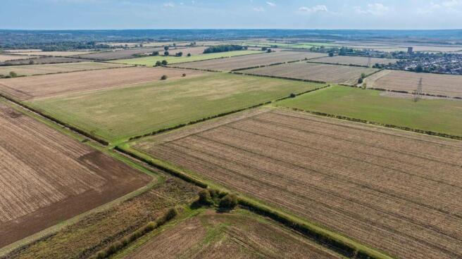
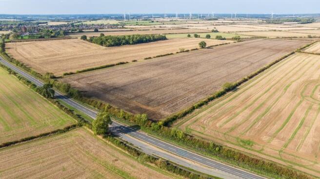
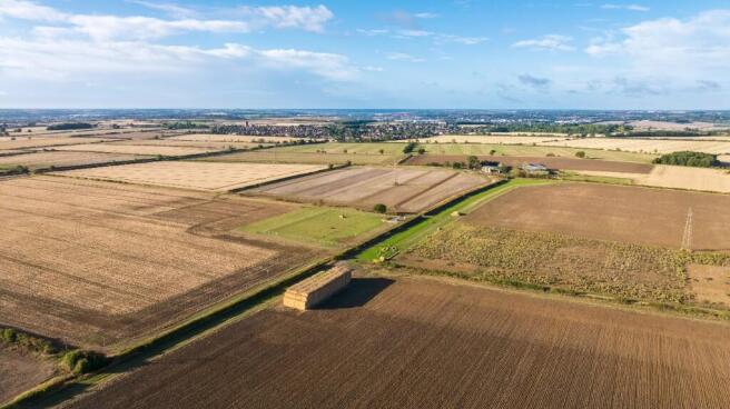
Description
The area has a long history of mining for ironstone with former ironworks based at Finedon, Irthlingborough and Wellingborough before being restored into agricultural production.
In all extending to about 1,728 acres (699 ha).
The Estate is made up of three Agricultural Holdings Act tenancies and four Farm Business Tenancies, five blocks of in-hand woodland and allotments let on short term agreements.
Offering opportunities for renewable energy and development there is also BNG potential to serve the large scale developments identified within Northamptonshire's local plan.
Method of Sale:
The property is available for sale as a whole by Private Treaty.
Tenure & Possession:
The property is sold freehold and subject to the occupancies set out in these particulars.
Boundaries:
All boundaries outlined on the attached plans are for identification purposes only. Potential buyers are responsible for confirming the boundaries.
Any mistakes, omissions, or inaccuracies will not allow the buyer to cancel the contract or claim compensation.
Wayleaves, Easements & Rights of Way:
The property is being sold subject to and with the benefit of all rights including; rights of way, whether public or private, light, support, drainage, water and electricity supplies and other rights and obligations, easements and quasi-easements and restrictive covenants and all existing and proposed wayleaves and easements whether referred to in these particulars or not.
There are a number of public rights of way over the Estate, as well as overhead lines.
Sporting, Timber & Mineral Rights:
All sporting, timber and mineral rights held in hand and are included in the freehold sale, insofar as they are owned.
Health & Safety:
Given the nature of a working farm, including areas of former quarry workings now restored to agricultural use, viewings are strictly by appointment with selling agents only. Prospective purchasers should not approach the property independently. Due to the Estate's former uses, we ask that viewers exercise caution and remain with appointed representatives during visits. Neither the seller nor the selling agents are responsible for the safety of those viewing the property, and accordingly, those viewing the property do so at their own risk.
Covenants & Restrictions:
There are restrictions and covenants listed on the Land Registry Title deeds. Further information will be made available in a data room.
Viewings:
Strictly by appointment with the Vendors agents.
Local Authority:
North Northamptonshire Council
Data Room:
Further planning, legal and technical information will be made available in a data room.
Brochures
The Finedon Estate, Wellingborough, Northamptonshire

NEAREST STATIONS
Distances are straight line measurements from the centre of the postcode- Wellingborough Station2.3 miles
- Kettering Station5.5 miles
About Ceres Property LLP, Saffron Walden
Ceres Property, Council Offices, London Road, Saffron Walden, CB11 4ERNotes
Disclaimer - Property reference TheFinedonEstate. The information displayed about this property comprises a property advertisement. Rightmove.co.uk makes no warranty as to the accuracy or completeness of the advertisement or any linked or associated information, and Rightmove has no control over the content. This property advertisement does not constitute property particulars. The information is provided and maintained by Ceres Property LLP, Saffron Walden. Please contact the selling agent or developer directly to obtain any information which may be available under the terms of The Energy Performance of Buildings (Certificates and Inspections) (England and Wales) Regulations 2007 or the Home Report if in relation to a residential property in Scotland.
Map data ©OpenStreetMap contributors.