
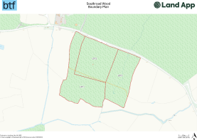
Lot2 Southroad Wood, Warehorne Road
- PROPERTY TYPE
Land
- SIZE
365,904 sq ft
33,994 sq m
Description
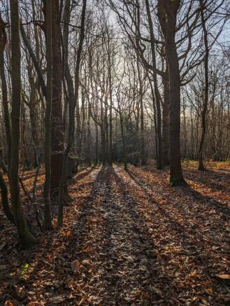
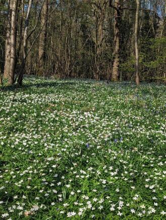
This woodland block is situated within the middle of the woodland parcel and is known as Southroad Wood. Access is via a new gate that is located at the entrance from the lay-by; secured with a padlock. A small timber storage shed used for maintenance is situated in the centre of Lot 2 and benefits from a log burner and separate w/c shed.
Brochures
Property ParticularsLot2 Southroad Wood, Warehorne Road

NEAREST STATIONS
Distances are straight line measurements from the centre of the postcode- Ham Street Station2.6 miles
- Appledore Station3.1 miles
Notes
Disclaimer - Property reference Lot2SouthroadWood. The information displayed about this property comprises a property advertisement. Rightmove.co.uk makes no warranty as to the accuracy or completeness of the advertisement or any linked or associated information, and Rightmove has no control over the content. This property advertisement does not constitute property particulars. The information is provided and maintained by BTF Partnership, Heathfield. Please contact the selling agent or developer directly to obtain any information which may be available under the terms of The Energy Performance of Buildings (Certificates and Inspections) (England and Wales) Regulations 2007 or the Home Report if in relation to a residential property in Scotland.
Map data ©OpenStreetMap contributors.