

Vicarage Hill, Farnham, Surrey, GU9
- PROPERTY TYPE
Plot
- SIZE
Ask agent
Key features
- Full planning permission granted (planning reference WA/2024/01788)
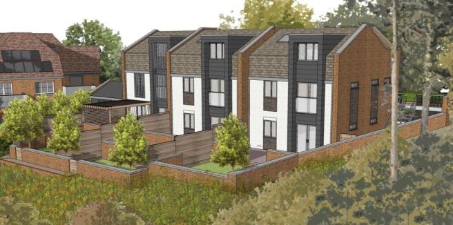
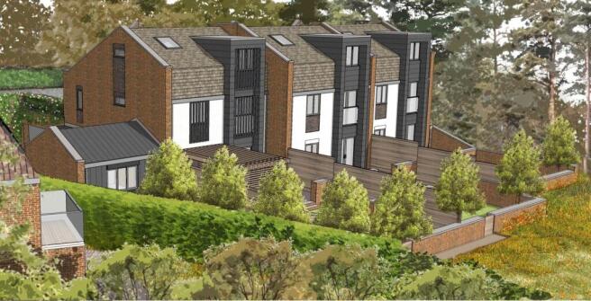
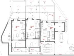
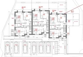
- Planning for three, three storey, 4-bedroom town houses with private gardens and parking.
- GIA of circa circa 6,363 sq ft
- Superb elevated leafy views to the rear over the valley, with a south westerly aspect
- Prime and sought after South Farnham location
- Viewing highly recommended
Description
A rare chance to acquire a fully consented residential development site in prime South Farnham, with planning permission granted for three, three storey townhouses (total GIA approximately 6,363 sq ft).
The site is within walking distance of the highly regarded South Farnham Infant and Junior Schools, local shops, The Bourne Tennis Club, Farnham Mainline Station (London Waterloo approximately 55 mins) and the vibrant Town Centre.
Opportunities like this in such a sought-after location are extremely limited.
For more information, please contact Nick Eaton on or email
Viewings strictly by appointment only.
Vicarage Hill, Farnham, Surrey, GU9

NEAREST STATIONS
Distances are straight line measurements from the centre of the postcode- Farnham Station0.7 miles
- Aldershot Station3.4 miles
- Bentley Station3.6 miles

Notes
Disclaimer - Property reference HPA250346. The information displayed about this property comprises a property advertisement. Rightmove.co.uk makes no warranty as to the accuracy or completeness of the advertisement or any linked or associated information, and Rightmove has no control over the content. This property advertisement does not constitute property particulars. The information is provided and maintained by house.partnership, Covering London and The Country. Please contact the selling agent or developer directly to obtain any information which may be available under the terms of The Energy Performance of Buildings (Certificates and Inspections) (England and Wales) Regulations 2007 or the Home Report if in relation to a residential property in Scotland.
Map data ©OpenStreetMap contributors.