
Amenity Land & Woodland - Lot 2, Lindale, Grange-Over-Sands, Cumbria
- PROPERTY TYPE
Land
- SIZE
171,626 sq ft
15,945 sq m
Key features
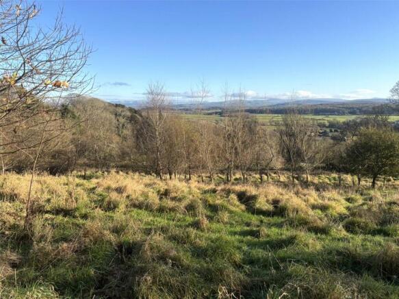
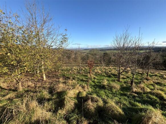
- An enclosure of amenity land and woodland located on the edge of the village of Lindale.
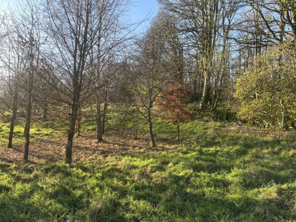
- Benefits from a fine selection of both recently planted and mature hardwood trees throughout.
- Occupies an elevated location, providing excellent southeasterly views toward Morecambe Bay.
- Access from roadside and across section of third party land.
- Of interest to local land and property owners, investors and those with environmental interests.
- Positioned on the periphery of the Lake District National Park [UNESCO World Heritage Site].
Description
Extending to about 3.94 acres (1.54 ha).
Particulars
Extending in all to circa 3.94 acres (1.59 hectares).
As Shown edged red on the Sale Plan
The property comprises a delightful parcel of amenity land and woodland. The parcel slopes up from the adjacent highway to provide stunning views towards Morecambe Bay.
To supplement the historic, mature trees and ornamental shrubs present across the holding, the parcel has been planted with a variety of hardwood tree species in recent years.
Boundaries comprise a mix of dry stone walls (with top wire), mature hedgerows and post/ wire fences. With the exception of the northerly fence line (adjacent to Lot 1), all boundaries appear to be in fair order.
Access is provided directly off Windermere Road and across the section of land dashed purple on the sale plan.
Directions
Heading west along the A590 (Lindale Bypass) from Meathop Roundabout, take the exit signposted ‘Lindale B5271’. Continue for approximately 0.2 miles and turn right onto Tower View. Continue along this road, through the village, for a further 0.3 miles; the land is located on the left hand side and marked by the selling agent’s board.
Location
The amenity land and woodland lies on the southern edge of the delightful village of Lindale, just 2 miles north of Grange-over-Sands and 12 miles south of Kendal, in the county of Cumbria.
What3Words: modules.lifetimes.replenish
Grid Reference: SD
Services
Tenure
Freehold.
Vacant Possession upon completion.
Services
It is understood that the land does benefit from mains water supplies, albeit such connections have not been utilised by the vendors during their ownership.
Sale Plan
The Sales Plan has been prepared by the Selling Agents for the convenience of prospective purchasers. They are deemed to be correct with any error, omission or misstatement shall not affect the sale. The purchasers must satisfy themselves as to its accuracy.
Environmental Stewardship Scheme
The land is not subject to any Environmental Stewardship Schemes.
Wayleaves and Easements
The property is sold subject to and with the benefit of any existing easements, wayleaves and rights of way. The sale is subject to all the existing rights of way, drainage, light, air support and other easements and quasi-easements and outgoings whether mentioned in these particulars or not.
Local Authority
Westmorland and Furness Council. Tel No: .
Boundaries
The ownership and maintenance responsibilities of the boundaries are indicated with the “T” marks on the sale plan. Where no “T” marks are shown, the responsibilities are unknown.
Note – the northern most boundary is not presently stockproof. The responsibility of reinstating this boundary, together with future maintenance, will fall on the successful purchaser of the adjacent parcel. [Formerly Lot 1].
It is incumbent for the purchaser of the adjacent field [Lot 1] to reinstate the abovementioned boundary within 3 months from the completion date.
Viewing
The land can be inspected at anytime by prospective buyers, provided a copy of these particulars are in their possession. All access is taken at your own risk. Tel No: , Option 3.
Brochures
ParticularsAmenity Land & Woodland - Lot 2, Lindale, Grange-Over-Sands, Cumbria

NEAREST STATIONS
Distances are straight line measurements from the centre of the postcode- Grange-over-Sands Station1.3 miles
- Kents Bank Station2.9 miles
- Arnside Station3.1 miles


Notes
Disclaimer - Property reference KEN260002. The information displayed about this property comprises a property advertisement. Rightmove.co.uk makes no warranty as to the accuracy or completeness of the advertisement or any linked or associated information, and Rightmove has no control over the content. This property advertisement does not constitute property particulars. The information is provided and maintained by H&H Land & Estates, Penrith. Please contact the selling agent or developer directly to obtain any information which may be available under the terms of The Energy Performance of Buildings (Certificates and Inspections) (England and Wales) Regulations 2007 or the Home Report if in relation to a residential property in Scotland.
Map data ©OpenStreetMap contributors.