Weighbridge Yard, Catfoss Lane, Brandesburton, Driffield, East Riding Of Yorkshire, YO25 8EJ
£62.86 per sq ft
Business rates & charges may apply

- SIZE AVAILABLE
23,863 sq ft
2,217 sq m
- SECTOR
Light industrial facility for sale

Key features
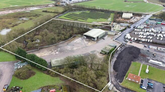
- Freehold industrial site
- Approx 8.5 acres
- Existing office and industrial units
- On site weighbridge
Description
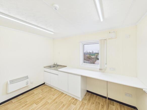
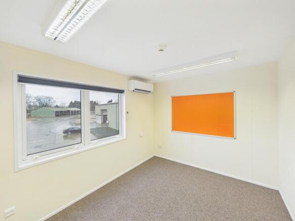
Within the site are a range of industrial buildings totalling over 20,000 sq ft together with a two storey office building of modular style construction,
The site surface is a range of concrete and stone/ hardcore. To the south of the site the with a dedicated entrance is a separate compound of approximately 1 acre which is fully secure, fenced and floodlit.
Surrounding the site to both the north west and east is an area of woodland extending to approximately 3.2 acres.
Weighbridge
There is an on-site weighbridge which has been regularly maintained and has current calibration certificates.
Access Road
The access road from Catfoss Lane to the site is included as part of the sale and is in addition to the quoted site area. The road has recently been fully resurfaced.
Energy Performance Certificates
EPC CertificateBrochures
Weighbridge Yard, Catfoss Lane, Brandesburton, Driffield, East Riding Of Yorkshire, YO25 8EJ

NEAREST STATIONS
Distances are straight line measurements from the centre of the postcode- Arram Station6.8 miles
About PPH Commercial Limited, Hull
Unit 5, First Floor, Pavillion House, Hesslewood Office Park, Ferriby Road, Hessle HU13 0LGNotes
Disclaimer - Property reference 26470FH. The information displayed about this property comprises a property advertisement. Rightmove.co.uk makes no warranty as to the accuracy or completeness of the advertisement or any linked or associated information, and Rightmove has no control over the content. This property advertisement does not constitute property particulars. The information is provided and maintained by PPH Commercial Limited, Hull. Please contact the selling agent or developer directly to obtain any information which may be available under the terms of The Energy Performance of Buildings (Certificates and Inspections) (England and Wales) Regulations 2007 or the Home Report if in relation to a residential property in Scotland.
Map data ©OpenStreetMap contributors.