Crab Orchard Way, Verwood, BH21
- PROPERTY TYPE
Land
- SIZE
182,952 sq ft
16,997 sq m
Key features
- 4.2 acres of grazing land
- Mains water connected
- Great Location
- Solar Panels In Place
Description
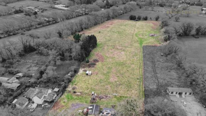
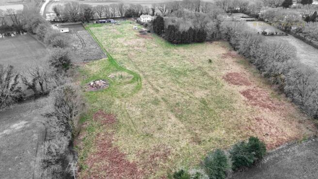
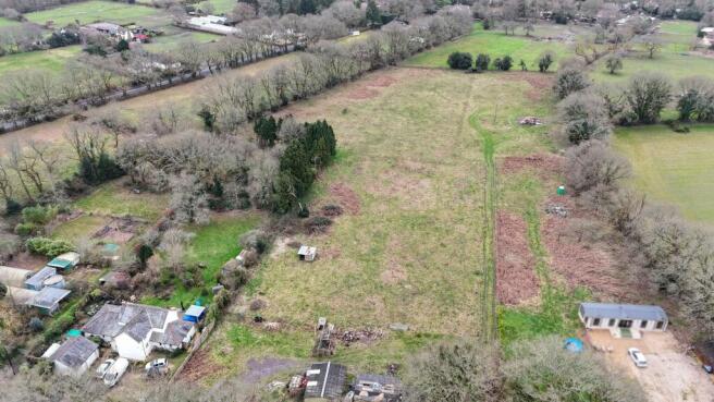
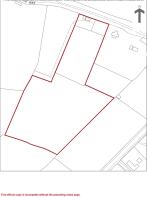
An excellent opportunity to acquire approximately 4.2 acres of green belt grazing land situated south of Crab Orchard Way, in a highly sought-after semi-rural position between Verwood and Three Legged Cross.
The parcel benefits from established stables already positioned on site, offering immediate usability for horse owners or those seeking private grazing.
A mains water supply is connected to the land. Electricity is available in the road, providing potential for connection subject to the relevant applications and permissions.
The land is classified as green belt and sits on a clay subsoil beneath the topsoil layer, a consideration for drainage and land management planning.
This is a rare opportunity to secure a manageable-sized paddock in a desirable Dorset location with strong local demand for equestrian and smallholding land.
For further information or to arrange a viewing, please contact the selling agent.
Crab Orchard Way, Verwood, BH21

NEAREST STATIONS
Distances are straight line measurements from the centre of the postcode- Bournemouth Station9.2 miles

Notes
Disclaimer - Property reference e4d31cb3-e69d-46af-a3e5-16b3c6e82bbc. The information displayed about this property comprises a property advertisement. Rightmove.co.uk makes no warranty as to the accuracy or completeness of the advertisement or any linked or associated information, and Rightmove has no control over the content. This property advertisement does not constitute property particulars. The information is provided and maintained by BrightWater, Ringwood. Please contact the selling agent or developer directly to obtain any information which may be available under the terms of The Energy Performance of Buildings (Certificates and Inspections) (England and Wales) Regulations 2007 or the Home Report if in relation to a residential property in Scotland.
Map data ©OpenStreetMap contributors.