
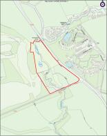
Felton, Morpeth, Northumberland, NE65
Letting details
- Let available date:
- Ask agent
- PROPERTY TYPE
Land
- SIZE
Ask agent
Description
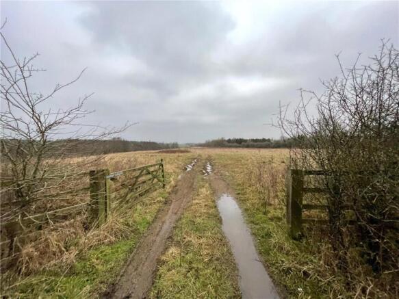
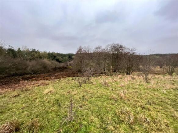
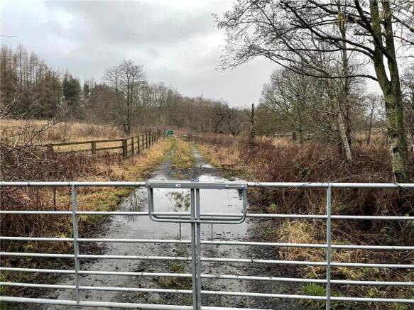
The property is understood to be classified as Grade 3 under the Agricultural Land Classification.
The soil type is slowly permeable seasonally wet slightly acid but base rich loamy and clayey soils.
TO RENT
The property is offered to rent as a whole by tender. Interested parties should submit the tender form attached on or before 12:00 noon Friday 17th April 2026.
TENURE
The land is offered to let on a two-year Farm Business Tenancy. A copy of the proposed terms of tenancy are available upon request.
BOUNDARIES
The tenant will be responsible for maintaining the boundaries.
WAYLEAVES EASEMENTS & RIGHTS OF WAY
Payments in respect of easements and wayleaves are to be retained by the landlord.
HEALTH & SAFETY
Please take care when inspecting the property and be as vigilant as possible for your own personal safety.
VIEWINGS
Viewings by appointment only, please contact the letting agents on
WHAT3WORDS
///revise.vibe.insulated
Brochures
ParticularsFelton, Morpeth, Northumberland, NE65

NEAREST STATIONS
Distances are straight line measurements from the centre of the postcode- Acklington Station3.9 miles
- Widdrington Station4.4 miles

About Carter Jonas Rural, Harrogate
Regent House, 13-15 Albert Street, Harrogate, HG1 1JX

Notes
Disclaimer - Property reference HGT260004_L. The information displayed about this property comprises a property advertisement. Rightmove.co.uk makes no warranty as to the accuracy or completeness of the advertisement or any linked or associated information, and Rightmove has no control over the content. This property advertisement does not constitute property particulars. The information is provided and maintained by Carter Jonas Rural, Harrogate. Please contact the selling agent or developer directly to obtain any information which may be available under the terms of The Energy Performance of Buildings (Certificates and Inspections) (England and Wales) Regulations 2007 or the Home Report if in relation to a residential property in Scotland.
Map data ©OpenStreetMap contributors.