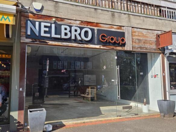
High Street, Carshalton, SM5 3AX
Letting details
- Let available date:
- Ask agent
- Furnish type:
- Unfurnished
- PROPERTY TYPE
Retail Property (high street)
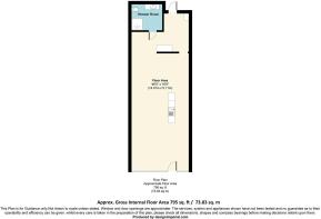
- SIZE
795 sq ft
74 sq m
Description
The property is situated on Carshalton High Street two doors from Costa Coffee and just yards from a bus stop. Further multiple traders include Oxfam, Sainsburys Local, Post Office and the Co-operative supermarket. A public car park is very close to this development.
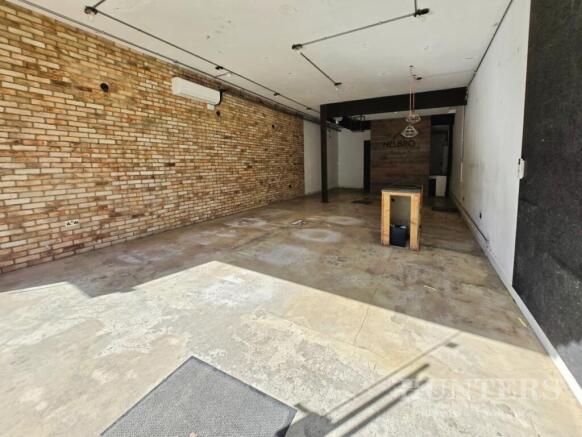
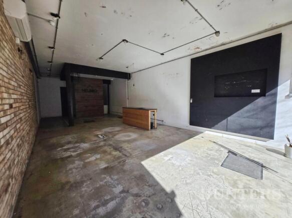
The property comprises a rectangular shape retail/office area, plus a kitchen/store room and a shower room/wc at the rear of the shop, with rear loading access.
TENURE
The property is offered by way of a new 5 year licence on standard full repairing and insuring terms.
USE/PLANNING
Prospective tenants are advised to make their own enquiries of the local Planning Authority (London Borough of Sutton) concerning existing and potential changes of use prior to offer.
WELL POSITIONED AND PROMINENT SHOP TO LET IN THE CENTRE OF CARSHALTON AND AVAILABLE UNDER A NEW LEASE WITH NO PREMIUM.
Brochures
High Street, Carshalton, SM5 3AXHigh Street, Carshalton, SM5 3AX

NEAREST STATIONS
Distances are straight line measurements from the centre of the postcode- Carshalton Station0.3 miles
- Wallington Station0.6 miles
- Carshalton Beeches Station0.7 miles


Notes
Disclaimer - Property reference 34544418. The information displayed about this property comprises a property advertisement. Rightmove.co.uk makes no warranty as to the accuracy or completeness of the advertisement or any linked or associated information, and Rightmove has no control over the content. This property advertisement does not constitute property particulars. The information is provided and maintained by Hunters, Carshalton. Please contact the selling agent or developer directly to obtain any information which may be available under the terms of The Energy Performance of Buildings (Certificates and Inspections) (England and Wales) Regulations 2007 or the Home Report if in relation to a residential property in Scotland.
Map data ©OpenStreetMap contributors.