
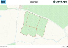
Lot1 Southroad Wood, Warehorne Road
- PROPERTY TYPE
Land
- SIZE
416,434 sq ft
38,688 sq m
Description
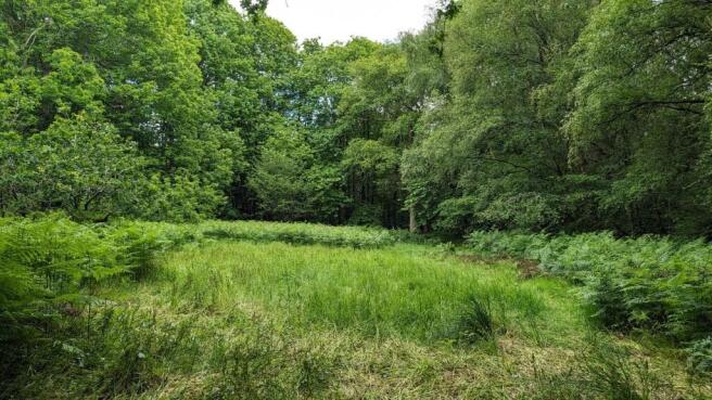
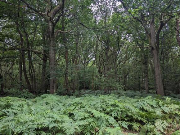
The woodland block is located to the west of the woodland parcel and is in a single L-shaped block, known as Ellis Wood. The woodland is in good order with a cleared area in the
centre with lots of flora and fauna. Other parts of the property are in need of further coppicing and selective thinning.
Brochures
Property ParticularsLot1 Southroad Wood, Warehorne Road

NEAREST STATIONS
Distances are straight line measurements from the centre of the postcode- Ham Street Station2.6 miles
- Appledore Station3.1 miles
Notes
Disclaimer - Property reference Lot1SouthroadWood. The information displayed about this property comprises a property advertisement. Rightmove.co.uk makes no warranty as to the accuracy or completeness of the advertisement or any linked or associated information, and Rightmove has no control over the content. This property advertisement does not constitute property particulars. The information is provided and maintained by BTF Partnership, Heathfield. Please contact the selling agent or developer directly to obtain any information which may be available under the terms of The Energy Performance of Buildings (Certificates and Inspections) (England and Wales) Regulations 2007 or the Home Report if in relation to a residential property in Scotland.
Map data ©OpenStreetMap contributors.