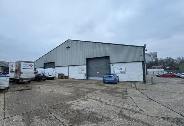
B, Bakers Wharf, Millbank Street, Southampton, Hampshire, SO14
£10.21 per sq ft
Business rates & charges may apply

- SIZE AVAILABLE
11,749 sq ft
1,092 sq m
- SECTOR
Light industrial facility to lease
Lease details
- Lease available date:
- Now
Key features
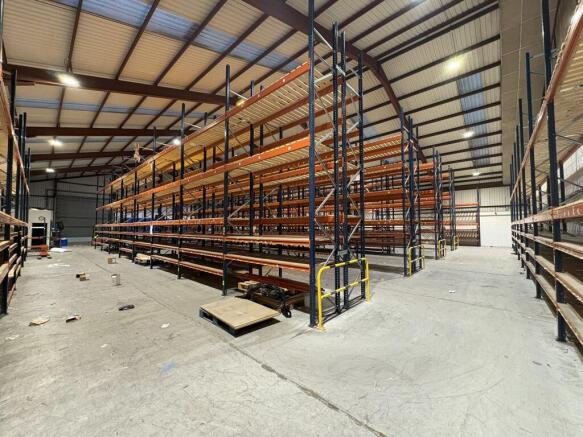
- Clear Height of 10.15m Under Ridge
- Substantial Forecourt
- Two Roller Shutter Loading Doors
- 3 Phase Power Supply
- 12 Designated Spaces in Estate Car Park
Description
The refurbishment works will include the removal of the existing racking, with the floor made good and finished with a hard-wearing epoxy-based coating, together with general unit repairs and redecoration.
The warehouse is accessed via two roller shutter loading doors, both measuring approximately 5.0m wide by 4.73m high. The unit has a minimum eaves height of approximately 4.77m, rising to a clear height of 10.15m under the ridge. The unit benefits from 3 phase power and LED lighting.
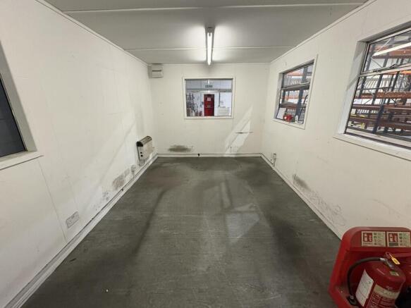
There are WCs and kitchen facilities. There are 12 designated car parking spaces in the estate car park. There is a substantial forecourt providing space for loading, HGV turning and additional car parking.
Energy Performance Certificates
Photo 16Brochures
B, Bakers Wharf, Millbank Street, Southampton, Hampshire, SO14

NEAREST STATIONS
Distances are straight line measurements from the centre of the postcode- Bitterne Station0.7 miles
- Woolston Station0.8 miles
- St. Denys Station0.9 miles
About Keygrove Chartered Surveyors, Southampton
Harbour Lights Maritime Walk, Ocean Village, Southampton, SO14 3TLNotes
Disclaimer - Property reference 1088LH. The information displayed about this property comprises a property advertisement. Rightmove.co.uk makes no warranty as to the accuracy or completeness of the advertisement or any linked or associated information, and Rightmove has no control over the content. This property advertisement does not constitute property particulars. The information is provided and maintained by Keygrove Chartered Surveyors, Southampton. Please contact the selling agent or developer directly to obtain any information which may be available under the terms of The Energy Performance of Buildings (Certificates and Inspections) (England and Wales) Regulations 2007 or the Home Report if in relation to a residential property in Scotland.
Map data ©OpenStreetMap contributors.