Commercial Properties For Sale by Bruton Knowles, Birmingham, including sold STC
12 results
Paid partnerships can play a role in listing order
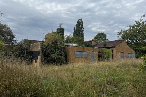
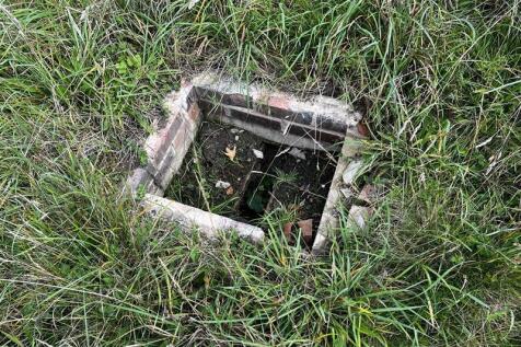

The Property is located in the centre of Alcester, comprising 0.68 hectares (1.68 acres) of relatively flat land which includes a single-storey school building of red brick construction under a mix of pitched clay tiled and flat metal roofs measuring approximately 978 sq m / 10,527 sq ft (Gross Internal Area). The Property has been vacant for several years and is in a state of significant disrepair. It is understood that the building also contains asbestos that would require remediation, and potential demolition. Externally the Property benefits from generous tarmacadam-surfaced parking provision, and the site boundary is a mix of wooden and metal fencing. Access is via two double gateways off Moorfield Road. The Property is within Flood Zone 3, with any development proposals of the site to be considered with this constraint in mind.

 1/3
1/3


Greenfield land in an edge of settlement location, on the south side of Birmingham. The Land is relatively flat and is currently used for grazing. There is a public right of way which crosses in an easterly/westerly direction. Boundaries are well defined, with a mixture of trees and mature hedgerows. The Land extends to approximately 7.539 acres (3.05 hectares) as defined approximately by the red line boundary on these particulars for identification purposes only.
- For Sale by Informal Tender
- Edge of Settlement location
- 7.539 acres (3.05 hectares)
1/5
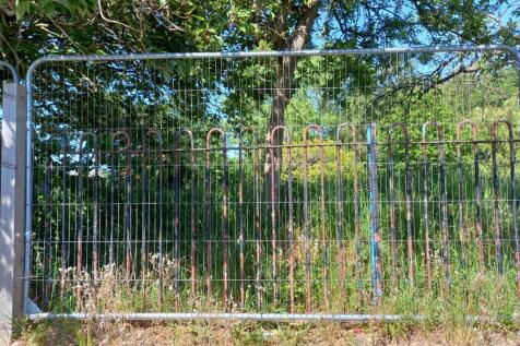
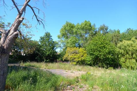
The Property comprises 0.29 of an acre of potential development land on Hillcrest Road in the residential Camp Hill area of Nuneaton. It forms part of Land Registry Title number WK202824, with the land to be disposed of outlined in red on the particulars. The building shown within the red line boundary and on publicly available Satellite imagery has been demolished, and the woodland to the rear of the title is to be excluded. The Property is regular in shape being roughly rectangular comprising scrubland, self-regenerated trees, and tarmacadam and concrete surfacing. This provides an excellent opportunity for potential residential development, with a positive pre-application response from the local planning authority in principle.
- Positive pre-application response for four residential dwellings
- Bare Site - building now demolished
- 0.29 of an acre (0.12 of a hectare)
1/4


A Strategic Land opportunity, comprising of some 5.59 acres, located on the north western edge of Wheaton Aston, a popular and sustainable South Staffordshire village. The Landowner will consider either an unconditional offer for the freehold interest, plus an uplift provision for 40 years of completion, or proposals for Promotion via an Option or Promotion agreement.
1/6


Residential Development Opportunity within sought after Worcester location. The site is located in a highly sustainable and accessible location to the north of Worcester. The site has been identified within the South Worcestershire Development plan and the Landowners (Worcester City Council and Worcestershire County Council) are seeking either conditional or unconditional bids.
 |1/14
|1/14


This is a rare opportunity to purchase a Grade II* listed commercial building situated in the historic village green of Kings Norton. The building comprises a number of large function rooms and smaller rooms that are used as offices or retail outlets.
1/6Residential Development Opportunity within sought after Worcester location. The site is located in a highly sustainable and accessible location to the north of Worcester. The site has been identified within the South Worcestershire Development plan and the Landowners (Worcester City Council and Worcestershire County Council) are seeking either conditional or unconditional bids.
1/31The Property is located in the centre of Alcester, comprising 0.68 hectares (1.68 acres) of relatively flat land which includes a single-storey school building of red brick construction under a mix of pitched clay tiled and flat metal roofs measuring approximately 978 sq m / 10,527 sq ft (Gross Internal Area). The Property has been vacant for several years and is in a state of significant disrepair. It is understood that the building also contains asbestos that would require remediation, and potential demolition. Externally the Property benefits from generous tarmacadam-surfaced parking provision, and the site boundary is a mix of wooden and metal fencing. Access is via two double gateways off Moorfield Road. The Property is within Flood Zone 3, with any development proposals of the site to be considered with this constraint in mind.
1/10


A former school built in circa. 1907, then as a centre for adults with learning and physical disabilities and now vacant. The Property within a demise of 0.303 ha (0.75 acres) comprises the former main school building and rear extension plus additional building, tarmacadam playground and garage. The Property is a rare opportunity with scope for alternative uses subject to planning - education, commercial or residential. The Property is for sale by informal tender with unconditional offers preferred but subject to planning permission considered.
1/12


This Property provides the opportunity to acquire a single storey purpose built, former youth centre dating from the mid 1960's in the centre of the town of Studley. It benefits from a hard-surfaced forecourt providing car parking for 10 vehicles and a fenced multi-use games area. Internally, the building comprises a main hall, with a kitchen, dining area, offices, and several additional open rooms around its perimeter. The building measures approximately 3,957 sq ft (Gross Internal Area) within a plot of 0.4 of an acre. The Property is offered with vacant possession and presents the chance for a use in line with its current configuration, or potentially for redevelopment to an alternative use subject to planning.
1/3Greenfield land in an edge of settlement location, on the south side of Birmingham. The Land is relatively flat and is currently used for grazing. There is a public right of way which crosses in an easterly/westerly direction. Boundaries are well defined, with a mixture of trees and mature hedgerows. The Land extends to approximately 7.539 acres (3.05 hectares) as defined approximately by the red line boundary on these particulars for identification purposes only.
1/5The Property comprises 0.29 of an acre of potential development land on Hillcrest Road in the residential Camp Hill area of Nuneaton. It forms part of Land Registry Title number WK202824, with the land to be disposed of outlined in red on the particulars. The building shown within the red line boundary and on publicly available Satellite imagery has been demolished, and the woodland to the rear of the title is to be excluded. The Property is regular in shape being roughly rectangular comprising scrubland, self-regenerated trees, and tarmacadam and concrete surfacing. This provides an excellent opportunity for potential residential development, with a positive pre-application response from the local planning authority in principle.


 1/4
1/4A Strategic Land opportunity, comprising of some 5.59 acres, located on the north western edge of Wheaton Aston, a popular and sustainable South Staffordshire village. The Landowner will consider either an unconditional offer for the freehold interest, plus an uplift provision for 40 years of completion, or proposals for Promotion via an Option or Promotion agreement.
1/1
The Land comprises an area of grassland bounded by mature trees and hedgerows on three sides, and a wooden post and rail fence to the north. The extent of the Land being sold is defined by the red line boundary on these particulars and extends to approximately 4.13 acres (1.67 hectares). The boundary is for identification purposes only, and its exact position will need to be accurately defined on site as part of the sales process.
1/2

The Land is generally flat and comprises approximately 17.5 acres of arable land bound by mature trees and hedgerows. It is currently accessed from the northwest corner through a single gate off Upper Wick Lane. The Land is included within the Adopted South Worcestershire Development Plan Review (South Worcestershire Development Plan Review 2021 - 2041 - South Worcestershire Development Plan) as a strategic allocation forming part of an 83.29-hectare site at Rushwick (SWDPR 56): Land within the strategic allocation at Rushwick will be developed to deliver approximately 1,000 new dwellings within the Plan period, provide at least 5 hectares of employment land, a new railway station, a new primary school, retail and supporting services and other community facilities. See page 188 of the South Worcestershire Development Plan Review for an indictive concept plan. The Vendor supported the proposed allocation throughout the development of the SWDPR, entering into a Statement of Common Ground on 12 February 2025 stating that it will work with the South Worcestershire Councils and the other landowners on delivering the proposed expansion of Rushwick. Any future landowner is expected to comply with the stated objectives of RES and work with the South Worcestershire Councils and third-party landowners.
1/17


The Property is a locally listed former school that has been vacant for several years. The building is of red brick construction under a series of pitched clay tile roofs, with single glazed windows throughout. The Property comprises several classrooms, assembly room(s), WCs, reception rooms and offices. The Property is in a state of disrepair following a period of extended vacancy, with significant refurbishment works required throughout. Externally, the Property beneftis from tarmacadam surfaced car parking to the rear and an adjoining area of woodland /scrubland along the southern boundary. The Property extends to approximately 0.7 acres, with the building measuring approximately 14,823 sq ft (Gross Internal Area).
