Near Streatley, Reading, Berkshire
- PROPERTY TYPE
Land
- SIZE
381,586 sq ft
35,450 sq m
Description
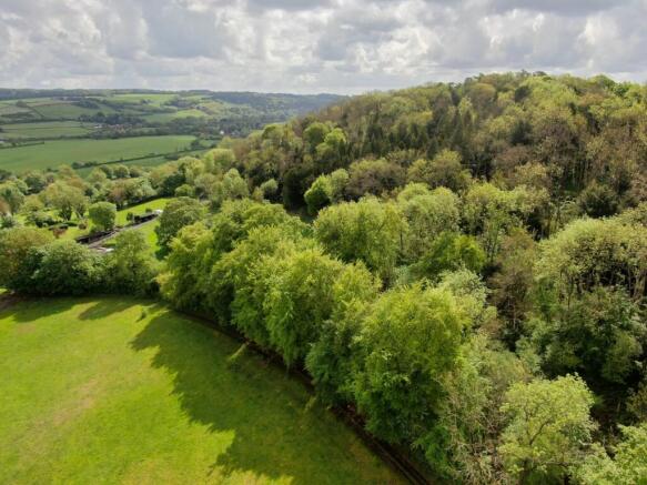
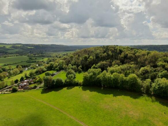
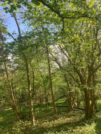
comprises mature and semi mature broadleaves, including yew, ash, whitebeam (single stems and coppiced), beech, horse chestnut, silver birch and an understory of hazel.
The woodland has the latent characteristics of the unusual lowland beech: yew woodland. There is no precise data on the total extent of native lowland beech and yew in the UK, but it is known to have
declined in area by woodland clearance and/or replanting with non-native species over the last 50 years. That makes this woodland
quite unusual as the age and quantity of the yew trees are seen infrequently. This woodland has widespread natural regeneration of ash - many of which are in poor condition, some planted horse chestnut and smaller numbers of conifers. These are eclectic and unusual species choices at this location.
The wood has great potential to revert back to its classic beech-yew state, with the ash providing valuable and high quality logs and the
thinning of other trees, such as the small number of conifers, giving space, light and better views out to the River Thames. The wood does not have the area nor the volume of trees to be managed exclusively for timber, although there is potential for domestic quantities of firewood. However, it does provide an opportunity for discerning
owners to manage, enjoy and reinstate an unusual wood. Adding to the unique nature of the wood is Grim’s Ditch, a c.15-20 metre wide “two banks and one ditch” embankment, which lies to the
south and west of the wood. It is a Scheduled Ancient Monument. Records show that the ditch is not earlier than the third century AD.
The middle of the nearest bank lies within this ownership. The woodland is accessed via a surfaced drive to the south west. The gateway access into the wood is wide enough for a 4x4 and/or small scale forestry machinery. Through the gate, a part obscured earthen track allows access to the woodland. There are two derelict
sheds within the wood. Although unusable, their location and presence gives potential for new structures. The woodland slopes
down towards the bridleway and the A329. There are impressive views to the south of the wood, over large fields and wooded hills.
This contrast with the glimpsed views through the trees of the wide and flat valley of the River Thames to the north.
Brochures
Web DetailsParticularsNear Streatley, Reading, Berkshire
NEAREST STATIONS
Distances are straight line measurements from the centre of the postcode- Goring & Streatley Station0.9 miles
- Pangbourne Station3.1 miles
- Cholsey Station4.0 miles
Notes
Disclaimer - Property reference JCC230006. The information displayed about this property comprises a property advertisement. Rightmove.co.uk makes no warranty as to the accuracy or completeness of the advertisement or any linked or associated information, and Rightmove has no control over the content. This property advertisement does not constitute property particulars. The information is provided and maintained by Strutt & Parker, Central Estates & Farm Agency. Please contact the selling agent or developer directly to obtain any information which may be available under the terms of The Energy Performance of Buildings (Certificates and Inspections) (England and Wales) Regulations 2007 or the Home Report if in relation to a residential property in Scotland.
Map data ©OpenStreetMap contributors.


