Milton Keynes, sometimes abbreviated MK, is a large town in Buckinghamshire, about 45 miles (72 km) south-east of Leicester and 49 miles (79 km) north-west of London. It is the administrative centre of the Borough of Milton Keynes. It was formally designated as a new town on 23 January 1967, with the design brief to become a 'city' in scale.
At designation, its 89 km2 (34 sq mi) area incorporated the existing towns of Bletchley, Wolverton and Stony Stratford along with another fifteen villages and farmland in between. It took its name from the existing village of Milton Keynes, a few miles east of the planned centre.
At the 2001 census the population of the Milton Keynes urban area, including the adjacent Newport Pagnell, was 184,506, and that of the wider borough, which has been a unitary authority independent of Buckinghamshire County Council since 1997, was 207,063 (compared with a population of around 53,000 for the same area in 1961). The Borough's population in 2009 is estimated to be nearly 241,000, with almost all the increase arising in the urban area.
Birth of a "New City" in the 1960s, the UK Government decided that a further generation of new towns in the South East was needed to relieve housing congestion in London.
Population trend of Borough and Urban Area 1801-2001, since the 1950s, overspill housing for several London boroughs had been constructed in Bletchley. Further studies in the 1960s identified north Buckinghamshire as a possible site for a large new town, a new city, encompassing the existing towns of Bletchley, Stony Stratford and Wolverton. The New Town (informally, "New City") was to be the biggest yet, with a target population of 250,000,[10] in a 'designated area' of 21,850 acres (34.1 sq mi; 88.4 km2).[11] The name "Milton Keynes" was taken from the existing village of Milton Keynes on the site.
The site was deliberately located equidistant from London, Birmingham, Leicester, Oxford and Cambridge with the intention[13] that it would be self-sustaining and eventually become a major regional centre in its own right. Planning control was taken from elected local authorities and delegated to the Milton Keynes Development Corporation (MKDC).
The Corporation's strongly modernist designs featured regularly in the magazines Architectural Design and the Architects' Journal. MKDC was determined to learn from the mistakes made in the earlier New Towns and revisit the Garden City ideals. They set in place the characteristic grid roads that run between districts, as well as the intensive planting, lakes and parkland that are so evident today. Central Milton Keynes was not intended to be a traditional town centre but a business and shopping district that supplemented the Local Centres in most of the Grid Squares. This non-hierarchical devolved city plan was a departure from the English New Towns tradition and envisaged a wide range of industry and diversity of housing styles and tenures across the city. The largest and almost the last of the British New Towns, Milton Keynes has stood the test of time far better than most, and has proved flexible and adaptable. The radical grid plan was inspired by the work of Californian urban theorist Melvin M. Webber (1921-2006), described by the founding architect of Milton Keynes, Derek Walker, as the "father of the city". Webber thought that telecommunications meant that the old idea of a city as a concentric cluster was out of date and that cities which enabled people to travel around them readily would be the thing of the future achieving "community without propinquity" for residents.
The Government wound up MKDC in 1992, 25 years after the new town was created, transferring control to the Commission for New Towns (CNT) and then finally to English Partnerships, with the planning function returning to local authority control (since 1974 and the Local Government Act 1972, the Borough of Milton Keynes). From 2004 to 2011, a Government quango, the Milton Keynes Partnership, had development control powers to accelerate the growth of Milton Keynes.
Along with many other towns and boroughs, Milton Keynes competed for formal city status in the 2000, 2002 and 2012 competitions, but was not successful. Nevertheless, the term 'city' is used by its citizens, local media and bus services to describe itself, perhaps because the term 'town' is taken to mean one of the constituent towns. Road signs refer to "Central Milton Keynes" or "Shopping" when directing traffic to the town centre.
GRID SQUARES
Milton Keynes Development Corporation planned the major road layout according to street hierarchy principles, using a grid pattern of approximately 1 kilometre (0.62 mi) interval, rather than on the more conventional radial pattern found in older settlements. Major internal roads run between communities, rather than through them: these distributor roads are known locally as grid roads and the spaces between them - the districts - are known as grid squares.[20] Intervals of 1 kilometre (0.62 mi) were chosen so that people would always be within walking distance of a bus stop. Consequently each grid square is a semi-autonomous community, making a unique collective of 100 clearly identifiable neighbourhoods within the overall urban environment. The grid squares have a variety of development styles, ranging from conventional urban development and industrial parks to original rural and modern urban and pseudo-rural developments. Most grid squares have Local Centres, intended as local retail hubs and most with community facilities as well. Originally intended under the Master Plan to sit alongside the Grid Roads, the Local Centres were mostly in fact built embedded in the communities and some are becoming unviable as a result of this and pressure from the new hypermarkets.
ROADS AND CYCLEWAYS
Roundabout junctions were built at intersections because the grid roads were intended to carry large volumes of traffic: this type of junction is efficient at dealing with these volumes. The major roads are dual carriageway, the others are single carriageway. Along one side of each single-carriageway grid road there is a (grassed) reservation to permit dualling or additional transport infrastructure at a later date. The edges of each grid square are landscaped and densely planted, some additionally have berms. The purpose of the berms is to reduce traffic noise for adjacent residents, but traffic noise can be significant at many locations even some distance from the grid roads.[citation needed] Traffic movements are fast, with relatively little congestion since there are alternative routes to any particular destination. The national speed limit applies on dual carriageway sections of the grid roads (70 miles per hour (113 km/h)) and most single carriageway grid roads (60 miles per hour (97 km/h)), although some single carriageway speed limits have now been reduced to 40 mph (64 km/h). Consequently the risk to unwary pedestrians and turning traffic is significant, although pedestrians rarely need to cross grid roads at grade, as underpasses exist in several places along each stretch of all of the grid roads. However, the new districts to be added by the expansion plans for Milton Keynes will depart from this model, with less separation and using 'at grade' crossings. Monitoring station data[21] shows that pollution is lower than in other settlements of a similar size. This can be partially attributed to the large number of trees, especially as trees line grid roads in most places.
There is a separate cycleway network (the "redways") that runs through the grid-squares and sometimes runs alongside the grid-road network. This was designed to segregate slow moving cycle and pedestrian traffic from fast moving motor traffic. In practice, it is mainly used for leisure cycling rather than commuting, mainly because the cycle routes include many underpasses beneath the grid-roads and because they take meandering scenic routes rather than straight lines. Despite what appears to be a desirable facility, rates of cycle commuting in Milton Keynes are well below the national average for urban areas. The detailed article includes a critical appraisal.
LINEAR PARKS
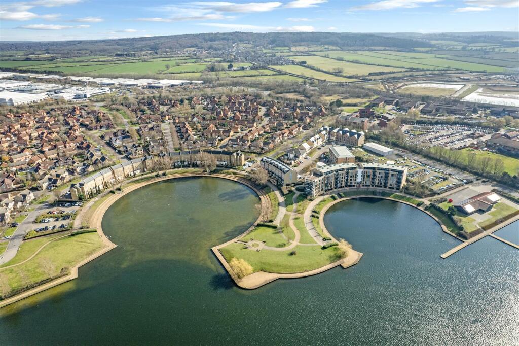
Caldecotte Lake, Milton Keynes, The flood plains of the Great Ouse and of its tributaries (the Ouzel and some brooks) have been protected as linear parks that run right through Milton Keynes.