2 bedroom flat for sale
Hamilton Terrace, St John's Wood NW8

- PROPERTY TYPE
Flat
- BEDROOMS
2
- BATHROOMS
2
- SIZE
1,199 sq ft
111 sq m
Key features
- 2 bedrooms
- 1 reception room
- 2 bathrooms
- Duplex
Description
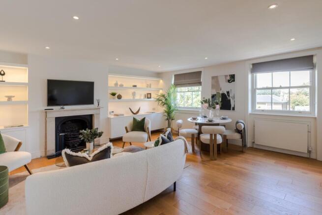
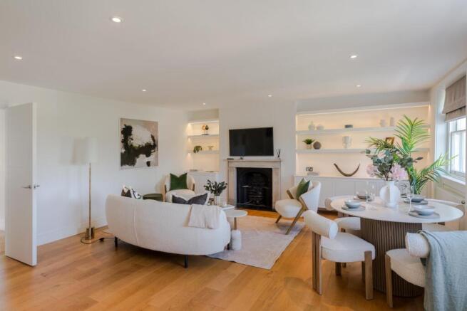
Accommodation comprises a spacious reception/dining room, a separate kitchen, a principal bedroom with en suite shower room, a second bedroom, a family bathroom and a utility room. The property also benefits from access to the loft space, which is ideal for extra storage and can be used as a study.
*Please note that we have been unable to confirm the next review dates for the service charge/ground rent. You should ensure that you or your advisors make your own inquiries.
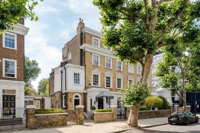
Hamilton Terrace is located on the west side of St John’s Wood, where one can find a number of world-famous landmarks, including the Abbey Road Studios (approximately 0.4 miles away) and the home of cricket, Lord’s Cricket Ground (approximately 0.8 miles away). St John’s Wood High Street is approximately 0.8 miles away and offers an array of boutique shops, restaurants and cafes.
St John’s Wood Underground Station (Jubilee Line) is approximately 0.6 miles away and is a fast transport link to Bond Street (approximately 5 minutes), London Bridge (approximately 14 minutes) and Canary Wharf (approximately 20 minutes). The open green spaces of Regent’s Park and Primrose Hill are also nearby.
Brochures
Brochure - Hamilton More Details- COUNCIL TAXA payment made to your local authority in order to pay for local services like schools, libraries, and refuse collection. The amount you pay depends on the value of the property.Read more about council Tax in our glossary page.
- Band: F
- PARKINGDetails of how and where vehicles can be parked, and any associated costs.Read more about parking in our glossary page.
- Ask agent
- GARDENA property has access to an outdoor space, which could be private or shared.
- Ask agent
- ACCESSIBILITYHow a property has been adapted to meet the needs of vulnerable or disabled individuals.Read more about accessibility in our glossary page.
- Ask agent
Hamilton Terrace, St John's Wood NW8
Add an important place to see how long it'd take to get there from our property listings.
__mins driving to your place
Get an instant, personalised result:
- Show sellers you’re serious
- Secure viewings faster with agents
- No impact on your credit score
Your mortgage
Notes
Staying secure when looking for property
Ensure you're up to date with our latest advice on how to avoid fraud or scams when looking for property online.
Visit our security centre to find out moreDisclaimer - Property reference SJW012283605. The information displayed about this property comprises a property advertisement. Rightmove.co.uk makes no warranty as to the accuracy or completeness of the advertisement or any linked or associated information, and Rightmove has no control over the content. This property advertisement does not constitute property particulars. The information is provided and maintained by Knight Frank, St John's Wood. Please contact the selling agent or developer directly to obtain any information which may be available under the terms of The Energy Performance of Buildings (Certificates and Inspections) (England and Wales) Regulations 2007 or the Home Report if in relation to a residential property in Scotland.
*This is the average speed from the provider with the fastest broadband package available at this postcode. The average speed displayed is based on the download speeds of at least 50% of customers at peak time (8pm to 10pm). Fibre/cable services at the postcode are subject to availability and may differ between properties within a postcode. Speeds can be affected by a range of technical and environmental factors. The speed at the property may be lower than that listed above. You can check the estimated speed and confirm availability to a property prior to purchasing on the broadband provider's website. Providers may increase charges. The information is provided and maintained by Decision Technologies Limited. **This is indicative only and based on a 2-person household with multiple devices and simultaneous usage. Broadband performance is affected by multiple factors including number of occupants and devices, simultaneous usage, router range etc. For more information speak to your broadband provider.
Map data ©OpenStreetMap contributors.


