
Shrewsbury, SY5
- PROPERTY TYPE
Land
- SIZE
1,704,503 sq ft
158,354 sq m
Key features
- Excellent Block of Grassland
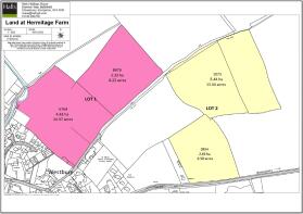
- Lot One - 19.19 acres
- Lot Two - 19.94 acres
- Good Access
- Available as a whole or in 2 lots
- Permanent Grassland
Description
Lot One - approximately 19.19 acres (7.76 ha)
Lot Two - approximately 19.94 acres (8.07 ha)
Lot 1- Offers in excess of £230,000
Lot 2- Offers in excess of £240,000
Situation - The land is located on the north-eastern edge of the village of Westbury. Lot 1 is approached via a right of way over the lane leading to Westbury School. Lot 2 can be approached using the same right of way, or alternatively is accessed via a gateway directly off the B4386 Westbury to Shrewsbury road.
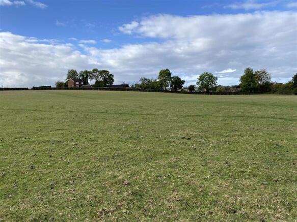
Description - The sale presents an opportunity to purchase a block of relatively level permanent grassland in a strong agricultural area.
The land has been used for grazing in recent years and has good stock proof boundaries.
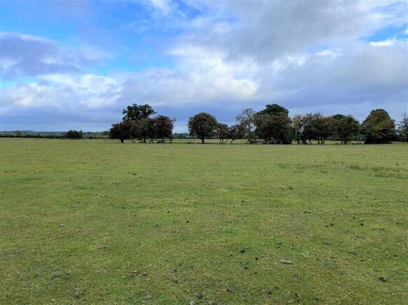
Lot One - Lot 1 comprises of approximately 19.19 Acres (7.76 Ha) of relatively level permanent grassland which is conveniently divided into two parcels and has a natural water supply from the Westbury Brook which crosses the north-western edge of field 6764.
The land is accessed via a prescriptive right of way over the lane leading to Westbury School and onwards to further agricultural land. Adjacent to the gateway off the lane in field 6764 there is a post and rail and gated gathering pen.
It benefits from an external boundary hedge with mature boundary and in-field trees.
See Attached Brochure for Field Schedule.
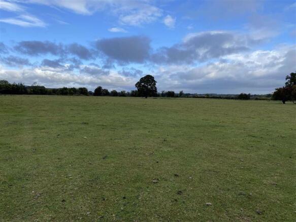
Lot Two - Lot 2 comprises of approximately 19.94 acres (8.07 ha) of undulating permanent grassland which is conveniently divided into two parcels and has a mains water supply to a trough in field 1075.
The land is accessed via a prescriptive right of way over the lane leading to Westbury School and onwards to further agricultural land and can also be accessed directly off the B4386 Westbury to Shrewsbury road.
The land has recently benefitted from complete re-fencing of the external boundaries with sheep netting and has a number of mature boundary and in-field trees.
Further Details - Please see attached brochure for further details.
Halls Holdings Ltd and any joint agents for themselves, and for the Vendor of the property whose Agents they are, give notice that: (i) These particulars are produced in good faith, are set out as a general guide only and do not constitute any part of a contract (ii) No person in the employment of or any agent of or consultant to Halls Holdings has any authority to make or give any representation or warranty whatsoever in relation to this property (iii) Measurements, areas and distances are approximate, Floor plans and photographs are for guidance purposes only (photographs are taken with a wide angled / zoom lenses) and dimensions shapes and precise locations may differ (iv) It must not be assumed that the property has all the required planning or building regulation consents. Halls Holdings Ltd, Halls Holdings House, Bowmen Way, Battlefield, Shrewsbury, Shropshire SY4 3DR. Registered in England 06597073.
Brochures
Brochure 1Shrewsbury, SY5

NEAREST STATIONS
Distances are straight line measurements from the centre of the postcode- Welshpool Station8.0 miles

About Halls Estate Agents, Property Auctions & Rural Sales
Halls Holdings House Bowmen Way Battlefield Shrewsbury SY4 3DR


Notes
Disclaimer - Property reference 31881545. The information displayed about this property comprises a property advertisement. Rightmove.co.uk makes no warranty as to the accuracy or completeness of the advertisement or any linked or associated information, and Rightmove has no control over the content. This property advertisement does not constitute property particulars. The information is provided and maintained by Halls Estate Agents, Property Auctions & Rural Sales. Please contact the selling agent or developer directly to obtain any information which may be available under the terms of The Energy Performance of Buildings (Certificates and Inspections) (England and Wales) Regulations 2007 or the Home Report if in relation to a residential property in Scotland.