
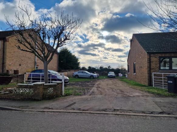
Main Street, Farcet, Peterborough, PE7
- PROPERTY TYPE
Plot
- SIZE
Ask agent
Key features
- Building Plot
- Full Planning Approved
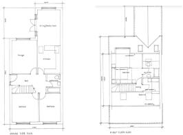
- One & Half Storey Dwelling
- Village Location
Description
*** BUILDING PLOT *** Full planning approved for a one and a half storey dwelling in the popular village of Farcet. Planning approved on 8th October 2021 via Huntingdonshire District Council. please call the office for further details
Farcet
Farcet is a village and civil parish in Cambridgeshire, England.[1] Farcet lies approximately 2 miles (3 km) south of Peterborough city centre, between Yaxley and the Peterborough suburb of Old Fletton. Farcet is situated within Huntingdonshire which is a non-metropolitan district of Cambridgeshire as well as being a historic county of England.[2]
The parish of Farcet was established in 1851, having previously been part of the parish of Stanground, its northern neighbour, when the vicarage of Stanground included the curacy of Farcet's village church.[3]
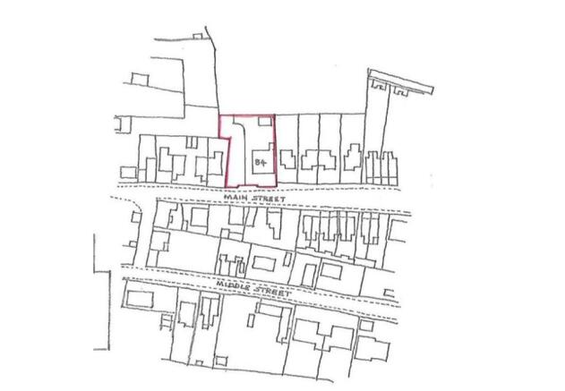
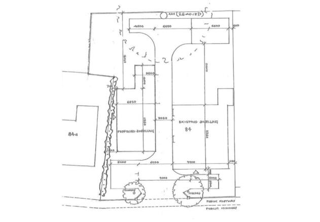
Building Plot
The site measures approx. 900 sq Meters.
Planning Approve via Huntingdonshire District Council
Planning Reference 21/01362/FUL
Approval Date 8th October 2021
Main Street, Farcet, Peterborough, PE7

NEAREST STATIONS
Distances are straight line measurements from the centre of the postcode- Peterborough Station2.9 miles
- Whittlesea Station4.6 miles

Notes
Disclaimer - Property reference 25811523. The information displayed about this property comprises a property advertisement. Rightmove.co.uk makes no warranty as to the accuracy or completeness of the advertisement or any linked or associated information, and Rightmove has no control over the content. This property advertisement does not constitute property particulars. The information is provided and maintained by Rosedale Land & New Homes, Peterborough. Please contact the selling agent or developer directly to obtain any information which may be available under the terms of The Energy Performance of Buildings (Certificates and Inspections) (England and Wales) Regulations 2007 or the Home Report if in relation to a residential property in Scotland.