
Occupation Road, Corby, Northamptonshire, NN17
- PROPERTY TYPE
Plot
- SIZE
Ask agent
Description
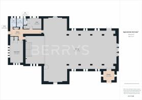
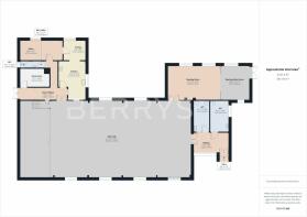
Approx. 8463sq ft (786sq ft) of combined internal area sitting within a plot measuring approx. 0.77 acres.
Location:
Train Stations at Corby, Kettering, Wellingborough, Market Harborough, Northampton, 1 hour to Kings Cross and St Pancras International, London.
Easy access to excellent private and government schools in Market Harborough, Kettering, and Corby.
Market Harborough – 11.5 miles, Northampton – 25 miles, Kettering – 10 miles, Coventry – 40 miles, Birmingham – 62 miles, London – 90 miles, Peterborough - 25 miles, Stamford - 17 miles.
Description:
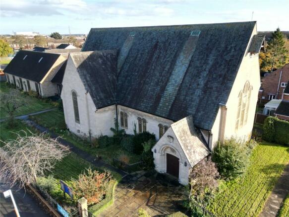
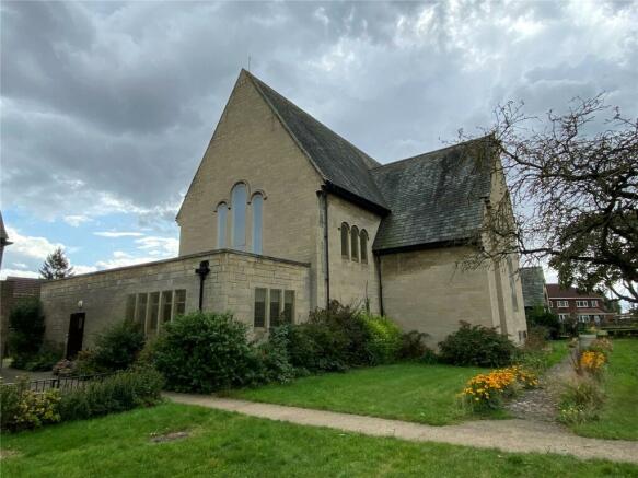
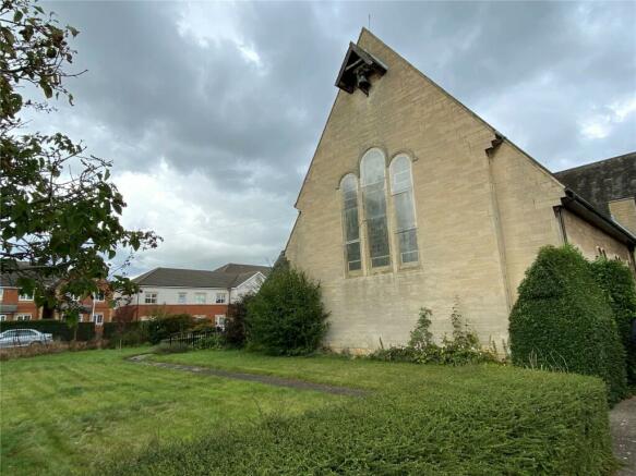
St Andrews Church and Church Hall is of traditional Church construction, with stone walls under a mix of pitched tile and flat roofs with Norman style round topped windows and door opening details. Construction is believed to have begun in the 1930's and opened to the congregation in 1938.
The Church is of a traditional cross shape design, with two small side aisles and a chancel section at one end with the communion table. Behind the chancel there is a session house meeting room, lobby area, toilets, and vestry.
The Church Hall offers meeting rooms, kitchen facilities and WC's.
Approx. 8463sq ft (786sq ft) of combined internal area sitting within a plot measuring approx. 0.77 acres.
Outside:
The church and the meeting room are surrounded by gardens with vehicular access off the side road creating off road parking. The gardens are mainly lawned retained by timber panel fencing and low-level walling.
Location Search:
What3words: ///supper.status.clip
Services:
The property benefits from gas central heating, electric, mains water and sewerage. Services have not been tested.
Method of Sale:
The freehold is for sale with vacant possession on completion.
Registered Title:
The Church and Hall will need to be registered upon completion during the conveyancing process.
Council Tax Band:
The property is exempt from paying business rates as a place of religious worship.
Interested parties should check future amounts payable via the local authority once a change of use has taken place.
Energy Performance Certificate:
St Andrews Church = Band
Church Hall = Band
Local Authority:
North Northamptonshire Council, Bowling Green Rd, Kettering, NN15 7QX
Tel:
Property Information Pack:
A detailed property information pack is available on request.
Agents Note:
There is a small memorial garden at one end of the site near the hall. There are 2 urns with interred ashes.
There may be a requirement for the future purchaser to respect the integrity of this small area and permit access to the families involved.
Virtual Tour Links:
Church =
Hall =
Brochures
ParticularsOccupation Road, Corby, Northamptonshire, NN17

NEAREST STATIONS
Distances are straight line measurements from the centre of the postcode- Corby Station0.6 miles

About the agent
Berrys, Kettering
42 Headlands, Kettering, NN15 7HR
Working nationally from a network of offices since 1890, Berrys can offer you and your property a unique combination of the benefits of small and national firms. By utilising our agents' in-depth local knowledge and combining it with the benefits of the technically diverse national team, we are able to present your property in the most strategic way for the market, maximising your chances of a smooth sale.
Industry affiliations

Notes
Disclaimer - Property reference KET230112. The information displayed about this property comprises a property advertisement. Rightmove.co.uk makes no warranty as to the accuracy or completeness of the advertisement or any linked or associated information, and Rightmove has no control over the content. This property advertisement does not constitute property particulars. The information is provided and maintained by Berrys, Kettering. Please contact the selling agent or developer directly to obtain any information which may be available under the terms of The Energy Performance of Buildings (Certificates and Inspections) (England and Wales) Regulations 2007 or the Home Report if in relation to a residential property in Scotland.
Map data ©OpenStreetMap contributors.