Land Off Hawse Lane, Coedkernew, Newport, NP10
Business rates & charges may apply

- SIZE
Ask agent
- SECTOR
Land for sale
Key features
- Approximately 47.25 acres (19.12 ha)
- Permanent Pastureland
- Roadside Access
- Available as a Whole
Description
Description
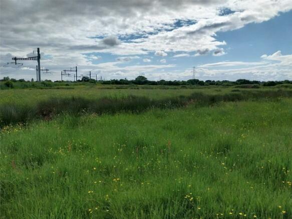
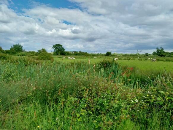
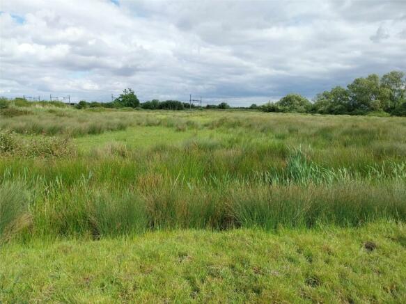
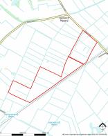
The land comprises in total approximately 47.25 acres (19.12 ha) of level grade four permanent pastureland separated into 10 parcels with internal access to each. The land is available as a single block and benefits from roadside access from the western boundary directly from Hawse Lane. Part of the southern boundary adjoins the railway line.
Situation
The land is located approximately 1.2 miles south of the A48 at Coedkernew and approximately 1.6 miles north-west of St. Brides in the City of Newport. The land benefits from reasonable transport links being situated approximately 2.7 miles from Junction 28 of the M4 Motorway.
Services
The land has a natural water supply from the adjoining reens. There are no mains service connections to the land. Purchasers are advised to make their own enquiries with the relevant providers for any nearby service connections in the local vicinity.
Designations
The land is located within the Gwent Levels – St. Brides Site of Special Scientific Interest (SSSI). We are not aware of a specific management agreement applying to the land. The land is subject to a small drainage rate payable annually to Natural Resources Wales. Purchasers are advised to make their own enquiries as to any additional designations which exist on the land.
Basic Payment Scheme
The land is registered with the Welsh Government for the Basic Payment Scheme (BPS). Entitlements are available by separate negotiation. The land is not in any Agri/Environmental Schemes.
Tenure
Freehold with vacant possession upon completion.
Boundaries
The Purchaser shall be deemed to have full knowledge of the boundaries and neither the Vendor nor the Agent should be required to produce evidence as to the ownership of the boundaries.
Lotting & Reserve
It is anticipated that the property will be offered as shown but the vendor reserves the right to withdraw, alter or amend the extent of the property being offered.
Easements, Covenants & Rights of Way
The land is sold subject to any rights, benefits or incidents of tenure which affect it. There is a single National Grid electricity pylon situated on the land which is subject to a wayleave agreement with National Grid Electricity Distribution.
Directions
From Newport head south-west from Junction 28 of the M4 on the A48. Take the second exit at the first roundabout, the first exit at the second roundabout and the third exit at the third roundabout to Church Lane. Continue along Church Lane past the Parc Golf Club to Hawse Lane. Continue along Hawse Lane for approximately 250 metres where the entrance gate to the land will be located on the right approximately 200 metres before the mainline railway bridge. When using the mobile application What3Words: /// director.perfumed.paddle
Viewing
Strictly by appointment with the Agents David James. Please telephone the Magor Office . Email: rhiannon.
Guide Price
Offers in Excess of £7,000 per acre.
Local Authority
Newport City Council
Brochures
Land Off Hawse Lane, Coedkernew, Newport, NP10

NEAREST STATIONS
Distances are straight line measurements from the centre of the postcode- Pye Corner Station2.8 miles
- Newport (S. Wales) Station3.8 miles
- Rogerstone Station3.9 miles
Notes
Disclaimer - Property reference MAG240077. The information displayed about this property comprises a property advertisement. Rightmove.co.uk makes no warranty as to the accuracy or completeness of the advertisement or any linked or associated information, and Rightmove has no control over the content. This property advertisement does not constitute property particulars. The information is provided and maintained by David James, Magor. Please contact the selling agent or developer directly to obtain any information which may be available under the terms of The Energy Performance of Buildings (Certificates and Inspections) (England and Wales) Regulations 2007 or the Home Report if in relation to a residential property in Scotland.
Map data ©OpenStreetMap contributors.