
Pontymister Industrial Estate, Risca, NP11 6NP
£16.60 per sq ft
Business rates & charges may apply
- SIZE AVAILABLE
329-772 sq ft
31-72 sq m
- SECTOR
Light industrial facility to lease
- USE CLASSUse class orders: B1 Business, B2 General Industrial and B8 Storage and Distribution
B1, B2, B8
Lease details
- Lease available date:
- Ask agent

Key features
- M4 Jct 28 - 4 miles
- Min eaves 3.5m / Max eaves 4m
- W.C. facilities
- 2.6m x 3m up and over door
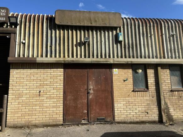
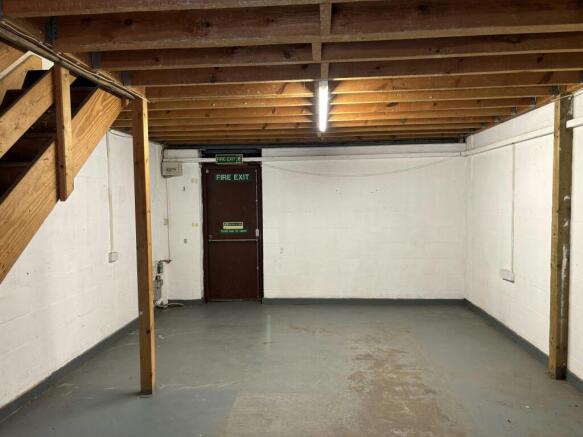
Description
These terraced units are ideal for light industrial, workshop and storage purposes. The units are of steel frame construction with minimum eaves 3.5m / maximum eaves 4.45m. The units benefit from an up and over loading door, measuring 2.6 m wide x 3m high and W.C facilities.
Unit 10 - 329 sq ft - £455
Unit 15 - 443 sq ft - £610
Pontymister Industrial Estate is a popular trade and industrial location – occupiers on the estate include Screwfix. It is also adjacent to Tesco Extra, Aldi and KFC. The estate is conveniently situated adjacent to the A467 dual carriageway which provides direct access to Junction 28 of the M4 Motorway, approximately 4 miles to the south.
These units are not suitable for vehicle storage or use as car garages.
Brochures
Pontymister Industrial Estate, Risca, NP11 6NP

NEAREST STATIONS
Distances are straight line measurements from the centre of the postcode- Risca & Pontymister Station0.3 miles
- Rogerstone Station1.2 miles
- Crosskeys Station1.9 miles
About Mileway Real Estate UK Limited, Cardiff
1 Centre Court Treforest Industrial Estate, Pontypridd CF37 5YRNotes
Disclaimer - Property reference 1XvumCJ7yZufeDvxnZDOy9. The information displayed about this property comprises a property advertisement. Rightmove.co.uk makes no warranty as to the accuracy or completeness of the advertisement or any linked or associated information, and Rightmove has no control over the content. This property advertisement does not constitute property particulars. The information is provided and maintained by Mileway Real Estate UK Limited, Cardiff. Please contact the selling agent or developer directly to obtain any information which may be available under the terms of The Energy Performance of Buildings (Certificates and Inspections) (England and Wales) Regulations 2007 or the Home Report if in relation to a residential property in Scotland.