
House Plot and Land At Glenmarkie, Glenisla, Blairgowrie, Angus, PH11
- PROPERTY TYPE
Land
- SIZE
1,390,435 sq ft
129,176 sq m
Description
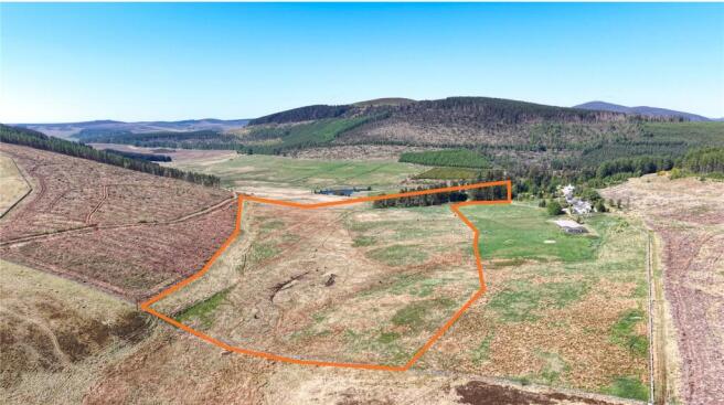
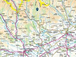
The plot at Glenmarkie is situated in a stunning rural location to the north of Kirkton of Glenisla and ideally located for those who are looking for house or second home in a quiet and remote location. For outdoor enthusiast the plot is located on the edge of the Cairngorms National Park with tourism hotspots such as Royal Deeside and Highland Perthshire within a 1 hour drive and Glenshee Ski area is 45 minutes’ drive making this an ideal destination, for walkers, skiers, sightseeing, or just relaxing. The town of Blairgowrie lies approximately 18 miles to the south and provides a wide range of facilities including local and national retailers, supermarkets, banks, medical services, leisure facilities and primary and secondary schooling.
Local amenities can be found in Alyth and Bridge of Cally which lie about 12 and 15 miles to the south and southwest respectively.
DESCRIPTION
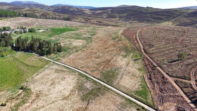
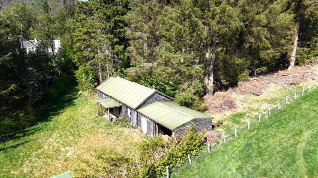
The plot comprises an attractive site with mature trees and a former stable block for Glenmarkie Lodge. Access to the plot is via a private track to the west which also serves other residential properties in the vicinity. Land extending to 31.92 acres lies to the east and can be accessed from the plot or the private track to the south. The land is down to rough grass but provides an opportunity for a range of uses such as a small holding, domestic energy or renewables generation or planting.
PLANNING
The plot benefits from detailed planning permission for the erection of a dwellinghouse granted by Angus Council on 5th September 2022 under ref: 22/00360/FULL. It should be noted that the stables building on site benefited from and earlier planning consent for conversion of the stables to form a dwellinghouse under ref: 21/00039/FULL.
We would recommend that any planning enquiries should be directed to:
Angus Council
Angus House
Orchardbank Business Park
Forfar
DD8 1AN
T:
W: angus.gov.uk
SERVICES
Mains Electricity
Private Water
Private Drainage
ACCESS
The plot is accessed via a private road understood to be owned by Forestry and Land Scotland leading from the public road at Kirkton of Glenisla.
ASKING PRICE
Our clients are seeking offers over £275,000 for their freehold interest in the subjects.
Interested parties will be notified of any closing date and requested to submit an offer. Galbraith will issue the required form of offer to interested parties on notification of the closing date. The form of offer will include the minimum information required and timescales for completing the transaction.
LEGAL COSTS
Each party will be responsible for their own legal costs incurred and the ingoing tenant will be responsible for the payments of LBTT, registration dues and VAT incurred there in.
VAT
The subject are note opted to tax, accordingly, VAT will not be payable on the purchase price.
ENTRY
To be mutually agreed.
POST CODE
PH11 8QB
WHAT3WORDS
To find this property location to within 3 metres, download and use What3Words and enter the
following 3 words: ///fame.closet.financial
Brochures
ParticularsHouse Plot and Land At Glenmarkie, Glenisla, Blairgowrie, Angus, PH11

NEAREST STATIONS
Distances are straight line measurements from the centre of the postcode- Pitlochry Station19.2 miles

About Galbraith, Stirling
Suite C1, Stirling Agricultural Centre, Stirling, FK9 4RN


Notes
Disclaimer - Property reference STR240230. The information displayed about this property comprises a property advertisement. Rightmove.co.uk makes no warranty as to the accuracy or completeness of the advertisement or any linked or associated information, and Rightmove has no control over the content. This property advertisement does not constitute property particulars. The information is provided and maintained by Galbraith, Stirling. Please contact the selling agent or developer directly to obtain any information which may be available under the terms of The Energy Performance of Buildings (Certificates and Inspections) (England and Wales) Regulations 2007 or the Home Report if in relation to a residential property in Scotland.