
Berriew, Welshpool, Powys, SY21

- PROPERTY TYPE
Plot
- SIZE
Ask agent
Key features
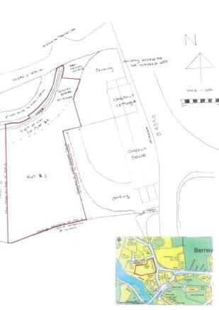
- Building plot with full planning permission
- Planning number 24/0671/FUL
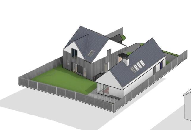
- Proposed detached dwelling with 4 bedrooms
- Located in the popular village of Berriew
- Services are connected to the site
Description
The village is well served with a primary school, church, pub, independant shops and sports facilities and is conviniently situated just off the A483 between Welshpool and Newtown.
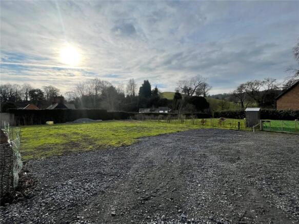
The plot offers approximately 0.164 acres (662.79m2) of level ground with services connected.
The current planning consent was approved on the 17th October 2024 and can be found on Powys County Council website or from our office. The planning number is 24/0671/FUL
The proposed develoment would include an individually designed detached dwelling with open plan ground floor living, offering a corridor to entrance hall and wc and an en-suite bedroom and garage. The first floor includes 3 bedrooms (1 En-suite) and a family bathroom.
The site is connected with mains water, electricity and BT, mains drainage is accessable via an on-site manhole.
Brochures
ParticularsBerriew, Welshpool, Powys, SY21

NEAREST STATIONS
Distances are straight line measurements from the centre of the postcode- Welshpool Station4.8 miles

Notes
Disclaimer - Property reference OSW250012. The information displayed about this property comprises a property advertisement. Rightmove.co.uk makes no warranty as to the accuracy or completeness of the advertisement or any linked or associated information, and Rightmove has no control over the content. This property advertisement does not constitute property particulars. The information is provided and maintained by Morris Marshall & Poole, Oswestry. Please contact the selling agent or developer directly to obtain any information which may be available under the terms of The Energy Performance of Buildings (Certificates and Inspections) (England and Wales) Regulations 2007 or the Home Report if in relation to a residential property in Scotland.
Map data ©OpenStreetMap contributors.