

Land for sale
The Highway, Newhaven
- PROPERTY TYPE
Land
- SIZE
Ask agent
Key features
- Rectangular Plot of Land
- Offers Potential for Future Development
- Sumi Rural Location
Description
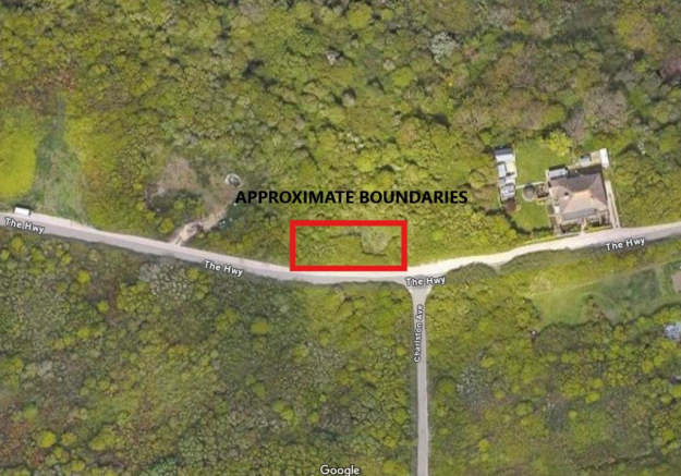
The plot is positioned just North of the junction of Charlston Avenue and the Highway and approximately measures 30m (99ft) x 10m (33ft). The land is located on the cusp of the Newhaven and Peacehaven border and just a few hundred yards from the South Coast Road, cliff top and bus routes.
This plot is approximately 9 miles from Brighton to the West and 5 miles from Seaford to the East. The plots are approximately a mile of the town centre with its shopping facilities and railway station and has excellent road links to all surrounding areas via the A27 / A259.
DESCRIPTION
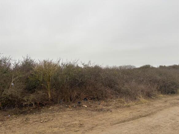
This vacant plot of land is reasonably level and have a southerly aspect and may have potential for residential development (subject to necessary consents), but at this moment in time just holds a speculative value.
Brochures
The Highway, NewhavenBrochureThe Highway, Newhaven

NEAREST STATIONS
Distances are straight line measurements from the centre of the postcode- Newhaven Harbour Station1.0 miles
- Newhaven Town Station1.1 miles
- Newhaven Marine Station1.2 miles

About Phillip Mann Estate Agents, Peacehaven
226-230 South Coast Road, Peacehaven, East Sussex, BN10 8JR


Notes
Disclaimer - Property reference 33689179. The information displayed about this property comprises a property advertisement. Rightmove.co.uk makes no warranty as to the accuracy or completeness of the advertisement or any linked or associated information, and Rightmove has no control over the content. This property advertisement does not constitute property particulars. The information is provided and maintained by Phillip Mann Estate Agents, Peacehaven. Please contact the selling agent or developer directly to obtain any information which may be available under the terms of The Energy Performance of Buildings (Certificates and Inspections) (England and Wales) Regulations 2007 or the Home Report if in relation to a residential property in Scotland.
Map data ©OpenStreetMap contributors.