Land, Netherhall Road
- SIZE AVAILABLE
994,039 sq ft
92,349 sq m
- SECTOR
Land for sale
Key features
- Attractive location
- Close proximity to the Lake District National Park
- Bids sought by noon Wednesday 23 April 2025
Description
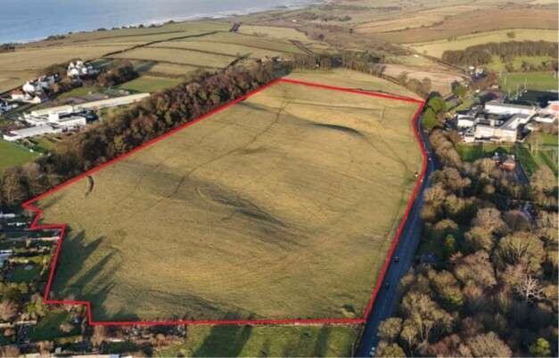
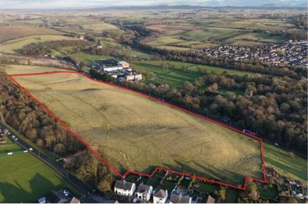
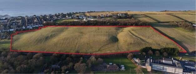
The site is bound by a tree belt to the north, Netherhall Road to the south, farmland to the east and housing to the west. Maryport CoE Primary School is located to the north. Netherhall Rugby Union Club and Netherhall Caravan Club are located to the south of the site and provide an attractive outlook onto mature trees and open green space.
The site is situated on Netherhall Road in the popular coastal town of Maryport approximately 7 miles north west of Cockermouth and 27 miles south west of Carlisle. The town is served by the A596 which connects to the A66 and Lake District to the west along the M6 which provides access to the national road network. Maryport is also served by Maryport Station which provides regular connections to Carlisle, Workington and Barrow in Furness.
Brochures
Land, Netherhall Road

NEAREST STATIONS
Distances are straight line measurements from the centre of the postcode- Maryport Station0.4 miles
- Flimby Station2.3 miles
- Workington Station5.7 miles
About Savills, Newcastle Upon Tyne
Savills, The Lumen, St. James Boulevard, Arthurs Hill, Newcastle Upon Tyne, NE4 5BZNotes
Disclaimer - Property reference 5FA27CE2-9857-45AC-9DC6-4A4A9CF0C180. The information displayed about this property comprises a property advertisement. Rightmove.co.uk makes no warranty as to the accuracy or completeness of the advertisement or any linked or associated information, and Rightmove has no control over the content. This property advertisement does not constitute property particulars. The information is provided and maintained by Savills, Newcastle Upon Tyne. Please contact the selling agent or developer directly to obtain any information which may be available under the terms of The Energy Performance of Buildings (Certificates and Inspections) (England and Wales) Regulations 2007 or the Home Report if in relation to a residential property in Scotland.
Map data ©OpenStreetMap contributors.