
Ruggin Road, West Buckland, Wellington, Somerset, TA21
- PROPERTY TYPE
Land
- SIZE
132,422 sq ft
12,302 sq m
Key features
- Range of modern farm buildings
- 3.04 acres of productive pastureland.
- Available as a whole or in four lots.
Description
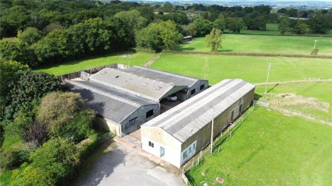
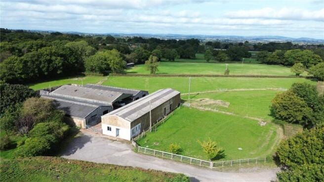
Located to the north of lot 1 this lot enjoys its own access via a concrete driveway and comprises a modern range of steel framed buildings which can be further described as follows:-
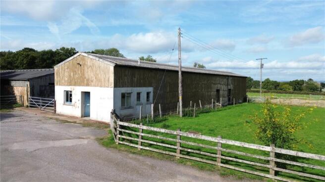
7 BAY GENERAL PURPOSE BARN (32m x 7.17m) of steel framed construction with block and clad elevations under a fibre cement roof currently containing an office, W.C., secure storage and an open fronted fodder store.
COVERED YARD (22.8m x 10.3m) of steel framed construction with timber clad elevations under a fibre cement roof.
FODDER BARN (22.8m x 10.7m) of steel framed construction under a fibre cement roof.
LEAN-TO (22.8m x 10.3m) of steel frame construction with concrete floor fitted with livestock pens. The land associated with this lot lies to the north and comprises a single enclosure of level pastureland.
SERVICES & OUTGOINGS
Lot 2. Main electric and water
Brochures
ParticularsRuggin Road, West Buckland, Wellington, Somerset, TA21

NEAREST STATIONS
Distances are straight line measurements from the centre of the postcode- Taunton Station4.8 miles


Notes
Disclaimer - Property reference TAU250173. The information displayed about this property comprises a property advertisement. Rightmove.co.uk makes no warranty as to the accuracy or completeness of the advertisement or any linked or associated information, and Rightmove has no control over the content. This property advertisement does not constitute property particulars. The information is provided and maintained by Greenslade Taylor Hunt, Taunton. Please contact the selling agent or developer directly to obtain any information which may be available under the terms of The Energy Performance of Buildings (Certificates and Inspections) (England and Wales) Regulations 2007 or the Home Report if in relation to a residential property in Scotland.
Map data ©OpenStreetMap contributors.