
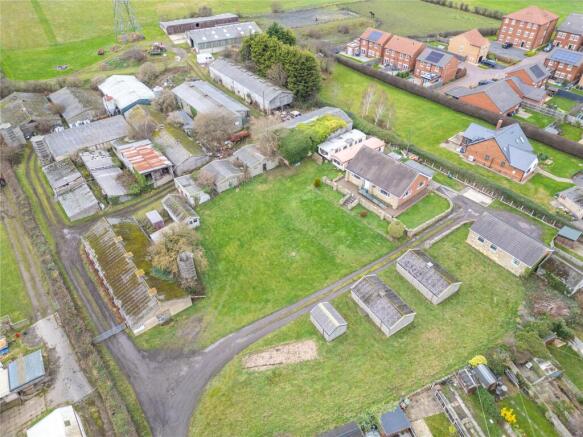
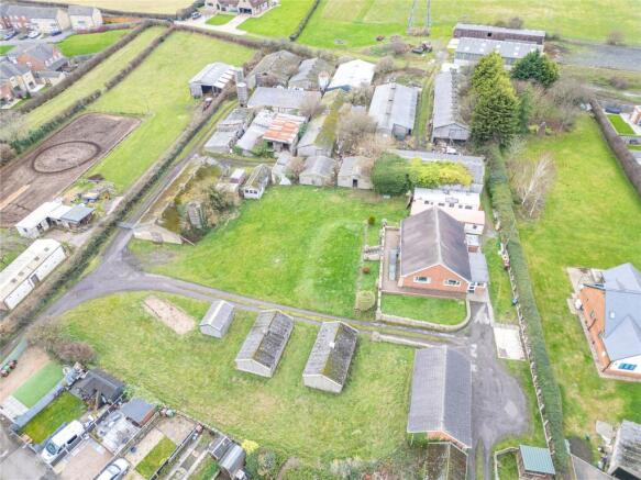
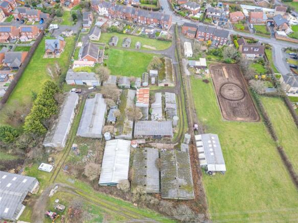
Wrenthorpe Lane, Wrenthorpe, Wakefield, West Yorkshire
- PROPERTY TYPE
Land
- SIZE
87,991 sq ft
8,175 sq m
Key features
- Detached bungalow
- 2.02 Acres of Land
- Several outbuildings
- Popular residential location
- Viewing recommended
Description
The land and outbuildings have been utilised for many years for farming and now provide the opportunity for a new owner to take full advantage and reinvent for a new purpose. The property is within the local settlement boundary.
Both the property and land are conveniently located off Wrenthorpe Lane, just a short drive to the M1 and A650 ideal for the daily commuter. There is also close proximity to Wakefield City Centre which offers two train stations, making it easy to travel between Leeds and London.
(NOTE the mines and minerals are excepted from the title and owned by a third party
Interested parties should carry out their own due diligence )
Brochures
ParticularsWrenthorpe Lane, Wrenthorpe, Wakefield, West Yorkshire

NEAREST STATIONS
Distances are straight line measurements from the centre of the postcode- Wakefield Westgate Station1.7 miles
- Outwood Station1.7 miles
- Wakefield Kirkgate Station2.4 miles

About Manning Stainton, New Homes
First Floor, Caledonia House Lawnswood Business Park Redvers Close Leeds LS16 6QY


Notes
Disclaimer - Property reference SPR242130. The information displayed about this property comprises a property advertisement. Rightmove.co.uk makes no warranty as to the accuracy or completeness of the advertisement or any linked or associated information, and Rightmove has no control over the content. This property advertisement does not constitute property particulars. The information is provided and maintained by Manning Stainton, New Homes. Please contact the selling agent or developer directly to obtain any information which may be available under the terms of The Energy Performance of Buildings (Certificates and Inspections) (England and Wales) Regulations 2007 or the Home Report if in relation to a residential property in Scotland.
Map data ©OpenStreetMap contributors.