Unit At Lower Lightwood Farm , Lightwood Lane , Worcester, WR6
£10.50 per sq ft
Business rates & charges may apply

- SIZE AVAILABLE
1,715 sq ft
159 sq m
- SECTOR
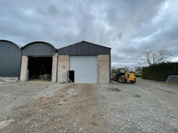
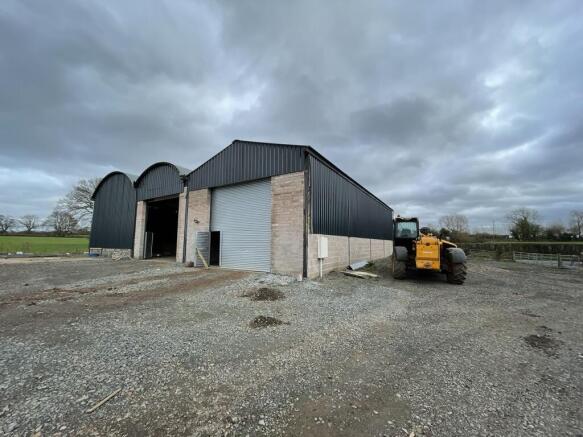
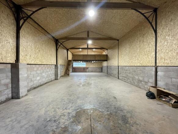
Light industrial facility to lease
Lease details
- Lease available date:
- Ask agent
Description
Ground Floor 127.97 sq m 1,377 sq ft
Mezzanine 31.39 sq m 338 sq ft
Total 159.36 sq m 1,715 sq ft
Lower Lightwood Farm is situated in Cotheridge, three miles west of Worcester. The property is immediately north of the A44 and lies seven miles west of Junction 7 of the M5 motorway, which is approximately a 12 minute drive. Access has been improved by the dualling of the Southern Link Road (A4440).
Worcester lies 31 miles south west of Birmingham, 101 miles north west of London, 27 miles north of Gloucester and 23 miles north east of Hereford. The city has excellent transport links with a direct mainline to both Birmingham and London, via Worcester Foregate Street, Worcester Shrub Hill and the new Worcester Parkway station. Worcester also lies to the west of Junctions 6 & 7 of the M5 motorway, providing access north to Birmingham, the M42, the M6 and the wider national motorway network
Brochures
Unit At Lower Lightwood Farm , Lightwood Lane , Worcester, WR6

NEAREST STATIONS
Distances are straight line measurements from the centre of the postcode- Worcester Foregate Street Station3.2 miles
- Worcester Shrub Hill Station3.7 miles
- Malvern Link Station4.9 miles
About GJS Dillon Ltd, Droitwich
7 Roman Way Business Centre, Berry Hill Industrial Estate, Droitwich, WR9 9AJNotes
Disclaimer - Property reference 13324LH. The information displayed about this property comprises a property advertisement. Rightmove.co.uk makes no warranty as to the accuracy or completeness of the advertisement or any linked or associated information, and Rightmove has no control over the content. This property advertisement does not constitute property particulars. The information is provided and maintained by GJS Dillon Ltd, Droitwich. Please contact the selling agent or developer directly to obtain any information which may be available under the terms of The Energy Performance of Buildings (Certificates and Inspections) (England and Wales) Regulations 2007 or the Home Report if in relation to a residential property in Scotland.
Map data ©OpenStreetMap contributors.