Freeman Way, Ashington, NE63
£6.55 per sq ft
Business rates & charges may apply

- SIZE AVAILABLE
9,926 sq ft
922 sq m
- SECTOR
Shop to lease
Lease details
- Lease available date:
- Ask agent
Description
Ashington is well-connected by road to nearby areas, including Newcastle upon Tyne (about 15 miles to the south). The A197 and A189 roads link Ashington with nearby towns like Bedlington and Morpeth. Although Ashington doesn’t have a direct train station, it is served by nearby stations Blyth and Morpeth.
There are also a variety of bus services that run through Ashington, providing links to nearby towns and cities, including Newcastle, Blyth, and Cramlington.
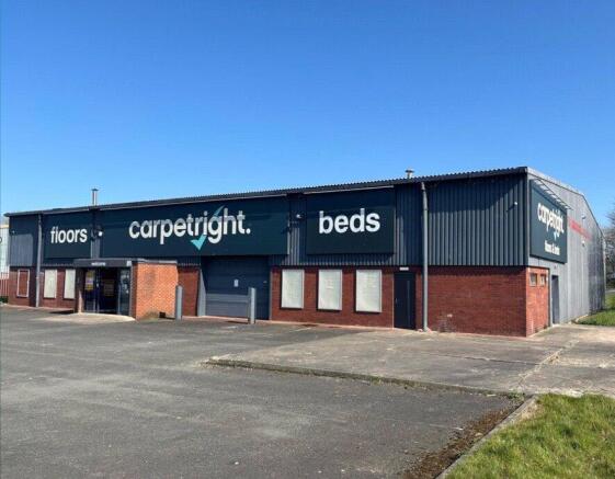
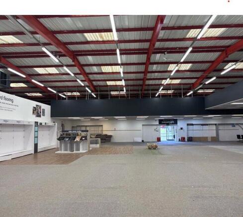
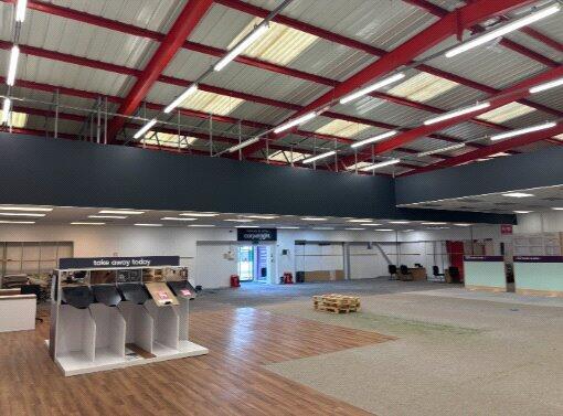
The property consists of a steel frame construction clad in profile sheeting. The property benefits from a large roller shutter door as well as a number of other pedestrian entrances.
The property has a minimum eaves height of 4.58m with an apex of 6.36m. Lighting is by way of strip fluorescent fittings and there is a large gas blower heater. The property also has basic welfare facilities.
Externally, there is a large yard to the front of the property that is suitable for parking.
Size 9,926 sq ft 922 sq m
For all enquiries and viewing arrangement please contact:
William Reavley
William.
Freeman Way, Ashington, NE63

NEAREST STATIONS
Distances are straight line measurements from the centre of the postcode- Ashington Station1.4 miles
- Pegswood Station3.9 miles
- Newsham Station4.5 miles
Notes
Disclaimer - Property reference CMR250032_L. The information displayed about this property comprises a property advertisement. Rightmove.co.uk makes no warranty as to the accuracy or completeness of the advertisement or any linked or associated information, and Rightmove has no control over the content. This property advertisement does not constitute property particulars. The information is provided and maintained by Bradley Hall, Newcastle Upon Tyne. Please contact the selling agent or developer directly to obtain any information which may be available under the terms of The Energy Performance of Buildings (Certificates and Inspections) (England and Wales) Regulations 2007 or the Home Report if in relation to a residential property in Scotland.
Map data ©OpenStreetMap contributors.