Ashburton DEVON
- PROPERTY TYPE
Land
- SIZE
Ask agent
Key features
- Stable Block
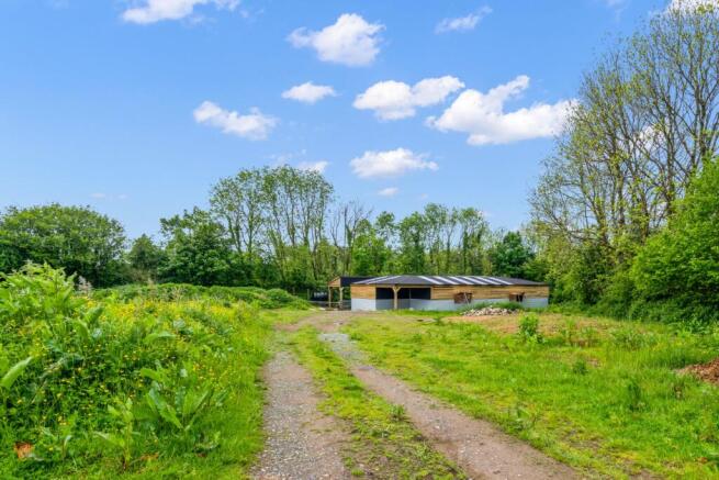
- Hay Barn
- Shepherd's Hut
- Paddocks
- Views
- Within The Heart Of Dartmoor National Park
- Property Ref EO8253
Description
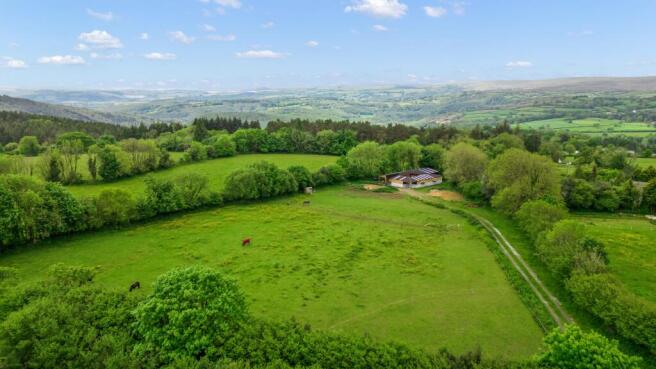
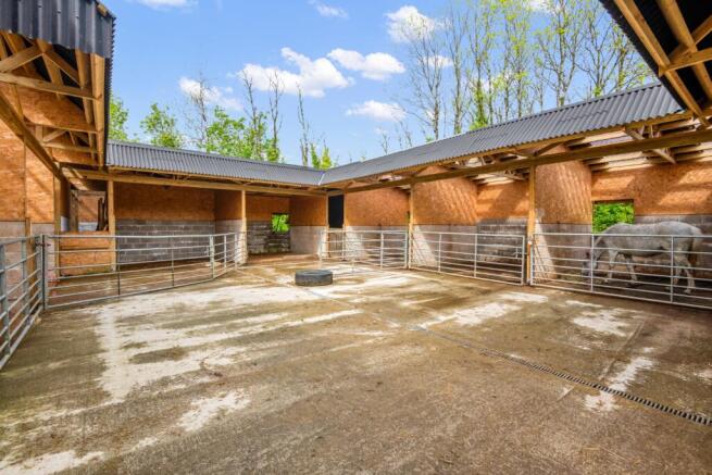
A RECENTLY BUILT STABLE BLOCK WITH EIGHT LOOSE BOXES, THREE FOALING BOXES, TACK ROOM, STORE, HAY BARN AND SHEPHERD'S HUT, SET IN APPROX. 5.4 ACRES OF SOUTH FACING, GENTLY SLOPING PASTURE, DIVIDED INTO TWO PADDOCKS WITH FAR-REACHING VIEWS ACROSS DARTMOOR NATIONAL PARK.
Recently Built Stable Block with 8 Loose Boxes, 3 Foaling Boxes, Tack Room, Store & Hay Barn
Two South-Facing Pasture Paddocks
Shepherd's Hut
Approx. 5.4 Acres In All
Set in the Heart of The Dartmoor National Park
The property lies in the heart of the Dartmoor National Park, some four miles from Ashburton which provides a range of local shops and amenities. A wider range of facilities are provided by Newton Abbot and there is easy access on to the A38 dual carriageway which connects to the M5 motorway.
No Mains Services Are Connected. Electricity is currently supplied by a generator and solar panels and there is a private borehole water supply.
Brochures
Brochure 1Ashburton DEVON

NEAREST STATIONS
Distances are straight line measurements from the centre of the postcode- Newton Abbot Station9.0 miles


Notes
Disclaimer - Property reference 37899_13507. The information displayed about this property comprises a property advertisement. Rightmove.co.uk makes no warranty as to the accuracy or completeness of the advertisement or any linked or associated information, and Rightmove has no control over the content. This property advertisement does not constitute property particulars. The information is provided and maintained by Rural Scene, Covering England, Wales and Scotland. Please contact the selling agent or developer directly to obtain any information which may be available under the terms of The Energy Performance of Buildings (Certificates and Inspections) (England and Wales) Regulations 2007 or the Home Report if in relation to a residential property in Scotland.
Map data ©OpenStreetMap contributors.