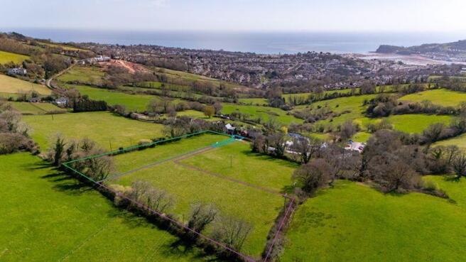
Lot 2: Higher Exeter Road, Teignmouth
- PROPERTY TYPE
Land
- SIZE
Ask agent
Key features
- 1.667 acres
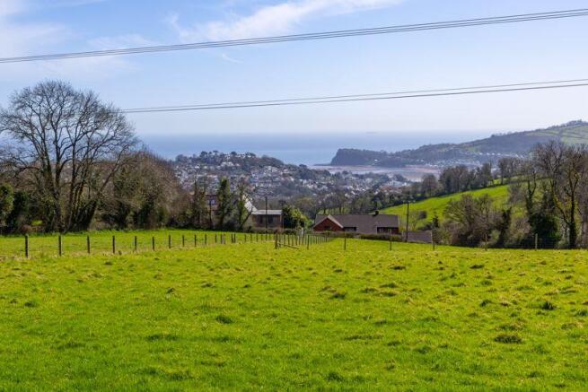
- Fantastic views
- Agricultural and amenity use with possible potential for development (stpp)
Description
Overview
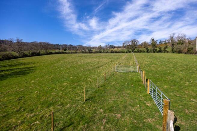
A gently sloping, south facing plot of beautiful fertile pasture with uninterrupted and elevated views. The plot has been fenced to create a plot of land, shared access. surrounded by mature hedgerow boundaries to the west and north.
Services:
Water: There is no water to the land.
Electricity: There are poles situated upon the property for a possible connection.
Management & Environmental
Currently the land is not under any schemes nor any management plan.
Wayleaves, Rights & Easements:
The property is sold subject to any Rights of Way, Wayleaves, Rights or Easements which exist at the time of sale whether they are mentioned in these particulars or not.
There is right of access granted to the owner of the neighbouring land to the east to maintain their water pipes that travel under the retained land, the shared access and the southern part of Lot1.
Lot 1 has a wayleave from the electricity poles & Airband, there is a BT manhole in the southeastern corner.
Lot 2 has a wayleave from the electricity poles.
Boundaries:
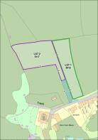
Where known these are clearly shown by T marks upon the sales plan who owns and is responsible for the boundaries.
Tenure:
The property is freehold with vacant possession - Land Registry Title no. ptDN188327 Land off Higher Exeter Road, Teignmouth
Restrictions and Covenants:
The property shall NOT be subject to any overage or uplift.
It must be noted that Lot 1 has a 'historic' restrictive covenant to building upon the southern part of the plot (the lower 1/3rd)
The property shall be subject to a restriction of no more than one caravan per Lot only.
Access:
The area hatched blue shall be retained, Lot 1 and Lot 2 shall have an unrestricted right over the area for access at all times for all purposes, there is to be no parking upon the blue hatched area. The cost of all maintenance or improvements (by mutual consent) shall be apportioned 1/3rd each Lot.
Local Authority:
Teignbridge District Council, Forde House, Brunel Road, Newton Abbot TQ12 4XX
National Grid, Feeder Road, Bristol BS2 0TB
Viewings by appointment only.
Rendells Rural Department - Newton Abbot Office
or email:
Drone Photography:
A video can be viewed at click on the link:
Plan:
The sale plan has been prepared using mapping software and is for identification purposes only, all would be purchasers are advised to make a thorough inspection of the property to be aware of its full extent. All measurements are approximated and for guidance only.
Directions:
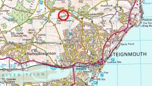
Driving of Teignmouth from the traffic lights continue up the B3192 signposted to Exeter. After 1.25 miles turn left onto Higher Exeter Road signed 'private road'. The land is 800yards on the right.
what3words: ///winters.leathers.vouch
Health & Safety:
Applicants/purchasers enter and view the property entirely at their own risk and no responsibility is accepted by the vendors or the agents for the purchasers/applicants whilst on the property.
Brochures
Property BrochureFull DetailsLot 2: Higher Exeter Road, Teignmouth

NEAREST STATIONS
Distances are straight line measurements from the centre of the postcode- Teignmouth Station1.6 miles
- Dawlish Station2.5 miles
- Dawlish Warren Station4.0 miles
Notes
Disclaimer - Property reference 12658707. The information displayed about this property comprises a property advertisement. Rightmove.co.uk makes no warranty as to the accuracy or completeness of the advertisement or any linked or associated information, and Rightmove has no control over the content. This property advertisement does not constitute property particulars. The information is provided and maintained by Rendells, Newton Abbot. Please contact the selling agent or developer directly to obtain any information which may be available under the terms of The Energy Performance of Buildings (Certificates and Inspections) (England and Wales) Regulations 2007 or the Home Report if in relation to a residential property in Scotland.
Map data ©OpenStreetMap contributors.