Ysbyty Ystwyth, Aberystwyth
- PROPERTY TYPE
Land
- SIZE
3,397,680 sq ft
315,655 sq m
Description
(EER N/A)
TENURE - Freehold
COUNCIL TAX (N/A)
For Sale By Private Treaty -
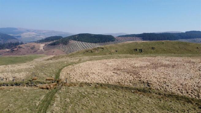
A useful parcel of improved and unimproved land amounting to 78 acres situated about 350 metres above sea level known as
LAND ADJ PANT Y FFYNNON and PENLAN FEDWEN
YSBYTY YSTWYTH
ABERYSTWYTH
CEREDIGION
SY25 6DG
The land is approached over a council-maintained road from Ysbyty Ystwyth which provides access to the B4343 Pontrhydygroes to Pontrhydfendigaid road. Limited local amenities are available at the nearby villages to include a primary school and village shop to the South at Pontrhydfendigaid. The university and market town of Aberystwyth is approximately 16 miles traveling distance on the coast and the market town of Tregaron is some 11 miles to the South. Both the aforementioned towns have a good range of amenities to include secondary schools.
Directions - (OS Grid Ref: SN )
WHAT3WORDS – bless.noble.beakers
Take the A487 South to Southgate, turn left on to the A4120 Devils Bridge road and turn immediately right onto the B4340 Pontrhydfendigaid road. At Abermagwr take the first turning left to Ponthrydygroes (signposted). At the village turn right at the T junction and proceed over the bridge for a mile to Ystbyty Ystwyth. Turn left near the church and proceed up the hill. Take the 2nd turning right and proceed to the very end of the road to the land.
Land Registry - The land is registered on Title Number CYM624719 and WA 618168
Grazing Rights - There are rights for 200 ewes(approx.) included in the sale. Reference Common register.
CL46 Entry No 5 (Part of 1000 rights)
CL49 Entry No 8 (Part of 1000 rights)
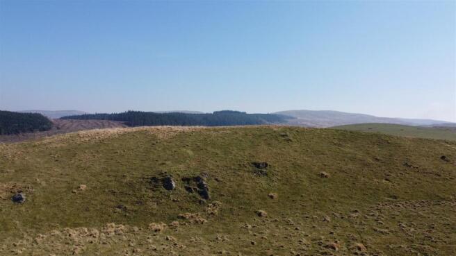
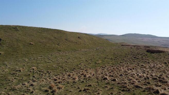
Description - The majority of the land is accessible with some areas of improved grazing which will be evident on inspection. There is a pond on the western boundary as highlighted on the plan and the land is high on conservation value.
The land in total amounts to 78.1 acres or thereabouts and is well worthy of inspection.
The Borth, Devils Bridge and Pontrhydfendigaid trail runs adjacent to the Eastern boundary and there are several other public footpaths that cross the land.
Schedule Of Acreages -
Os Plan - A plan of the land highlighting the boundaries in red are included with the particulars for identification purposes only.
Brochures
Ysbyty Ystwyth, AberystwythBrochureYsbyty Ystwyth, Aberystwyth

NEAREST STATIONS
Distances are straight line measurements from the centre of the postcode- Bow Street Station11.3 miles


Notes
Disclaimer - Property reference 33881747. The information displayed about this property comprises a property advertisement. Rightmove.co.uk makes no warranty as to the accuracy or completeness of the advertisement or any linked or associated information, and Rightmove has no control over the content. This property advertisement does not constitute property particulars. The information is provided and maintained by Aled Ellis & Co Ltd, Aberystwyth. Please contact the selling agent or developer directly to obtain any information which may be available under the terms of The Energy Performance of Buildings (Certificates and Inspections) (England and Wales) Regulations 2007 or the Home Report if in relation to a residential property in Scotland.
Map data ©OpenStreetMap contributors.