
Theale, Reading, Berkshire
- PROPERTY TYPE
Land
- SIZE
2,923,312 sq ft
271,585 sq m
Description
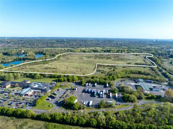
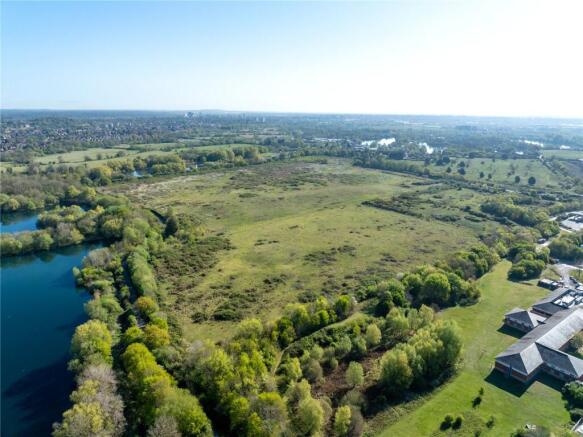
The land is located to the southeast of the village of Theale.
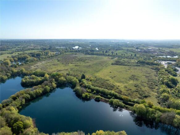
The land is a former quarry restored to farmland. The southwest portion of the land is Grade 3 and the northern section is Grade 4.
To the east and north of the land are various ponds and lakes and approximately 50% of the land is designated within either Flood Zone 2 or Flood Zone 3.
The land adjoins the M4 Eastbound Reading Services to the south.
The and extends to 67.11 acres (27.16 hectares)
RG30 3UQ is a nearby postcode.
Brochures
ParticularsTheale, Reading, Berkshire

NEAREST STATIONS
Distances are straight line measurements from the centre of the postcode- Reading Green Park Station1.3 miles
- Theale Station1.8 miles
- Reading West Station2.6 miles

About Bidwells, Rural Agency
Bidwell House, Trumpington Road, Cambridge, CB2 9LD


Notes
Disclaimer - Property reference RUR250115. The information displayed about this property comprises a property advertisement. Rightmove.co.uk makes no warranty as to the accuracy or completeness of the advertisement or any linked or associated information, and Rightmove has no control over the content. This property advertisement does not constitute property particulars. The information is provided and maintained by Bidwells, Rural Agency. Please contact the selling agent or developer directly to obtain any information which may be available under the terms of The Energy Performance of Buildings (Certificates and Inspections) (England and Wales) Regulations 2007 or the Home Report if in relation to a residential property in Scotland.
Map data ©OpenStreetMap contributors.