Rosudgeon, Penzance
- PROPERTY TYPE
Land
- SIZE
Ask agent
Key features
- 3.17 Acres
- Sought-after location
Description
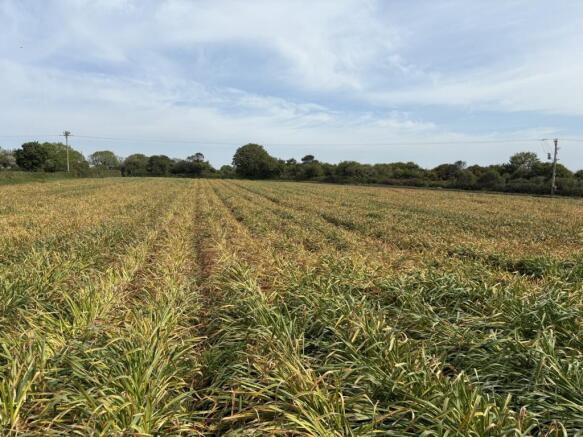
A single 3.17 acre paddock in a sought after location off Packet Lane, close to the village of Rosudgeon, in South West Cornwall.
The Land
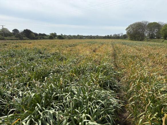
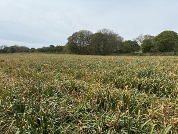
The land extends in area to 3.17 acres or thereabouts and is a single level paddock with Cornish hedge bank boundaries,
The land is accessed directly from the Council maintained Packet Lane which leads to the village of Rosudgeon, a short distance to the south of the main A394 road which links Penzance to the west and Helston to the east.
The land is currently partly planted in daffodil bulbs which are soon to be lifted and cleared, following which, the land could be re-seeded in grass or used to grow a variety of crops in the renowned 'early' and double cropping farming district where frosts are a rarity.
Separately metered mains water is connected to the land making it equally suitable for equestrian or livestock use.
Property Information
Services
Separately metered mains water is connected to the land. The Vendor will reserve the right to connect to the existing supply to the land and install pipework and sub-meters as necessary to supply other land in his retained ownership. Interested parties are advised to make their own enquiries to the relevant service providers.
Wayleaves, Easements & Rights of Way
The sale will be subject to and with the benefit of all wayleaves, easements and rights of way as may exist.
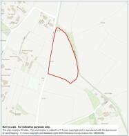
Particulars & Plan
Whilst every care is taken in the preparation of these particulars, their accuracy is not guaranteed and they do not constitute any part of an offer or contract. Any intending purchaser/s must satisfy themselves by inspection or otherwise as to the correctness of these particulars.
Location
The land is situated a short distance to the north of the village of Rosudgeon which is intersected by the main A394 road which links the south coastal harbour town of Penzance to the west and the former market town of Helston to the east. Nearby villages include Goldsithney and Germoe with the south Cornish coast at Prussia Cove or Perranuthnoe, short distances away. The town of Marazion and St Michael's Mount is about 3½ miles to the west.
Viewing & Directions
Viewers may access the land for viewing purposes with sale particulars in hand, during daylight hours adhering to the Countryside Code. Please notify the agents Lodge & Thomas of your intended visit. Tel: Email:
Directions
From the main A394 road in the centre of the village of Rosudgeon, take the turning into Packet Lane adjacent to The Packet Public House and the land will be found after about 1/4 of a mile on the right hand side indicated by a Lodge & Thomas for sale board at the field entrance.
what3words///plan.populate.tunes
Brochures
Brochure 1Rosudgeon, Penzance

NEAREST STATIONS
Distances are straight line measurements from the centre of the postcode- St. Erth Station3.7 miles
- Lelant Saltings Station4.1 miles
- Lelant Station4.4 miles


Notes
Disclaimer - Property reference LAT221474. The information displayed about this property comprises a property advertisement. Rightmove.co.uk makes no warranty as to the accuracy or completeness of the advertisement or any linked or associated information, and Rightmove has no control over the content. This property advertisement does not constitute property particulars. The information is provided and maintained by Lodge & Thomas, Truro. Please contact the selling agent or developer directly to obtain any information which may be available under the terms of The Energy Performance of Buildings (Certificates and Inspections) (England and Wales) Regulations 2007 or the Home Report if in relation to a residential property in Scotland.
Map data ©OpenStreetMap contributors.