Land for sale
Pease Pottage Hill, Crawley
- PROPERTY TYPE
Land
- SIZE
424,710 sq ft
39,457 sq m
Key features
- Amenity woodland
- Rarely available
- Convenient location
- Mixed mature woodland
- Native bluebells
- In total approximately 9.75 acres
Description
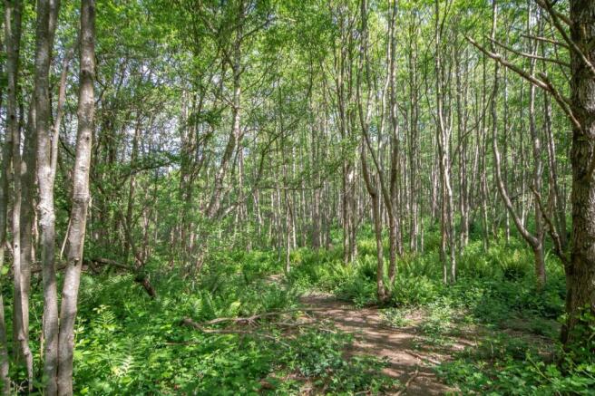
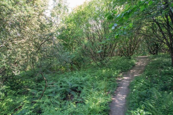
A rarely available and interesting block of mature woodland conveniently located within easy access of Crawley Town Centre and the A23. In total approximately 9.75 acres.
DESCRIPTION
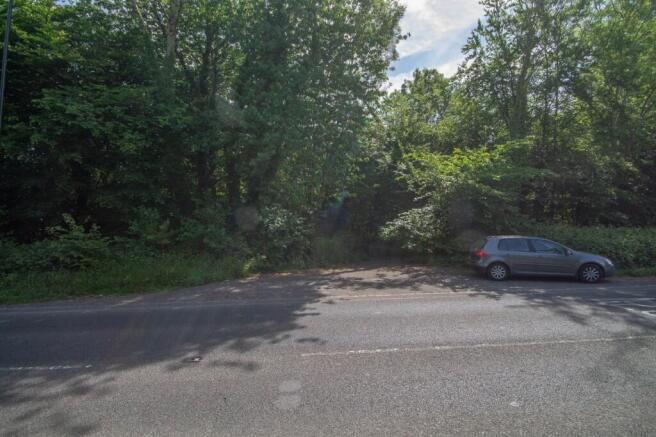
An irregular shaped parcel of mature woodland comprising of just under 10 acres including a mature chestnut coppice, oak and birch scrub. It is conveniently located just off the Brighton Road (A23) on the east side, close to the roundabout linking the M23 and A264. Crawley town centre, with its comprehensive shopping facilities
and amenities is easily accessible with excellent road links to Gatwick, London and Brighton via the M23. The land is considered suitable for a variety of uses subject to all necessary consents being obtainable. The property is accessed on foot and a vehicular right of way does exist over the adjoining land.
AGENTS NOTE
Please be advised there is an existing overage on this land for a period of 25 years from 2021 in the event that relevant planning permission is granted.
Brochures
ParticularsPease Pottage Hill, Crawley

NEAREST STATIONS
Distances are straight line measurements from the centre of the postcode- Crawley Station1.7 miles
- Ifield Station2.1 miles
- Three Bridges Station2.5 miles
About Batcheller Monkhouse, Haywards Heath
67-69 The Broadway, Haywards Heath, RH16 3AS


Notes
Disclaimer - Property reference HAY250110. The information displayed about this property comprises a property advertisement. Rightmove.co.uk makes no warranty as to the accuracy or completeness of the advertisement or any linked or associated information, and Rightmove has no control over the content. This property advertisement does not constitute property particulars. The information is provided and maintained by Batcheller Monkhouse, Haywards Heath. Please contact the selling agent or developer directly to obtain any information which may be available under the terms of The Energy Performance of Buildings (Certificates and Inspections) (England and Wales) Regulations 2007 or the Home Report if in relation to a residential property in Scotland.
Map data ©OpenStreetMap contributors.