Steep
- PROPERTY TYPE
Land
- SIZE
423,839 sq ft
39,376 sq m
Key features
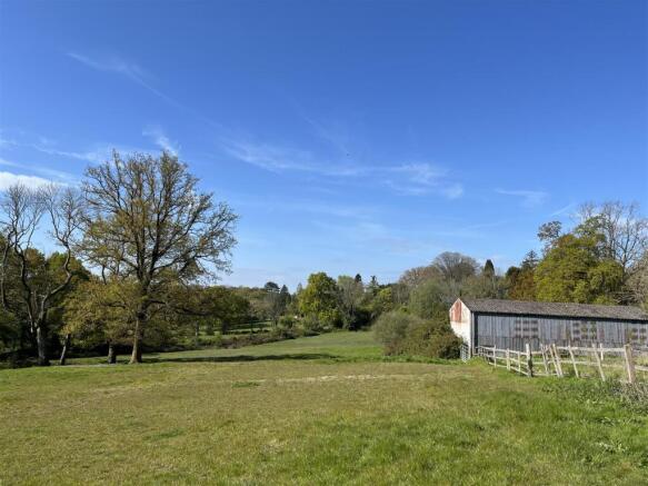
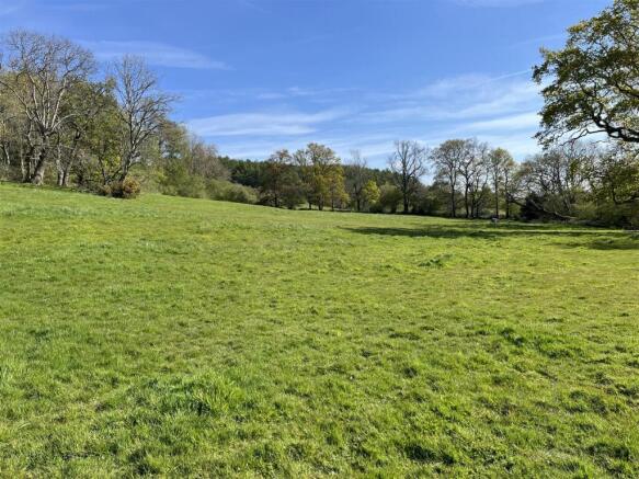
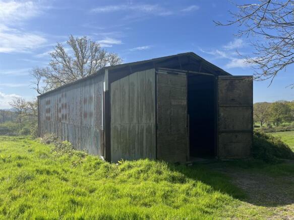
- Equestrian land and stables within the South Downs National Park
Description
Overall, the property extends to approximately 9.73 acres (3.94 ha), including the buildings.
Method Of Sale - The property is offered for sale as a whole by private treaty.
Access - The Land and Stables can be accessed via a right of way over a private track which links to the public highway (Mill Lane).
Services - The property does not benefit from electricity or water connection.
Wayleaves And Easements - The property is sold subject to and with the benefit of all rights, including rights of way (whether public or private), light, support, drainage, water and electricity supplies and any other rights and obligations, easements and proposed wayleaves for masts, pylons, stays, cables, drains and water, gas and any other pipes, whether referred to or not.
Tenure And Possession - The property is sold Freehold with vacant possession under part of Land Registry Title Numbers SH41743 and SH31055.
Boundaries - The purchaser(s) will be responsible for all boundary fences and any new fences.
Overage - The property is for sale subject to an overage clause of 30% of any uplift in value for development other than for agriculture or equestrian uses for a period of 30 years.
Plans, Areas And Schedules - These are based on the Ordnance Survey and are for reference only. They have been checked and computed by the selling agents and the Purchaser(s) shall be deemed to have satisfied themselves as to the description of the property. Any error or mis-statement shall not annul a sale or entitle any party to compensation in respect thereof.
Epc - The buildings do not require an EPC.
Directions - From Petersfield follow Bell Hill. After approximately 1 mile, take the right hand turn at the cross roads onto Church Road, just before the Cricketers Inn. Follow Church Road for approximately 0.2 of a mile. Turn left shortly after the village hall and follow Mill lane for approximately 0.7 mile and the land will be on your right hand side marked by a BCM board
Postcode - GU32 2DL
Local Authority - East Hampshire District Council
Tel:
South Downs National Park
Tel:
Viewings - By appointment with BCM Wilson Hill only.
What3words - ///crunching.informer.superhero
Brochures
SteepSteep

NEAREST STATIONS
Distances are straight line measurements from the centre of the postcode- Petersfield Station1.9 miles
- Liss Station2.0 miles
About BCM Wilson Hill, Winchester
The Old Dairy, Winchester Hill, Sutton Scotney, Winchester, Hampshire, SO21 3NZ


Notes
Disclaimer - Property reference 33943549. The information displayed about this property comprises a property advertisement. Rightmove.co.uk makes no warranty as to the accuracy or completeness of the advertisement or any linked or associated information, and Rightmove has no control over the content. This property advertisement does not constitute property particulars. The information is provided and maintained by BCM Wilson Hill, Winchester. Please contact the selling agent or developer directly to obtain any information which may be available under the terms of The Energy Performance of Buildings (Certificates and Inspections) (England and Wales) Regulations 2007 or the Home Report if in relation to a residential property in Scotland.
Map data ©OpenStreetMap contributors.