Land at Henwick Road, Henwick Road, Worcester

- SIZE AVAILABLE
12,197 sq ft
1,133 sq m
- SECTOR
Land for sale
Key features
- Consented development opportunity situated in a prominent city position.
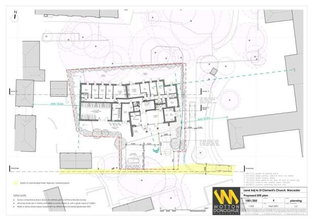
- The total site area extends to approximately 0.28 acres (0.11 hectares).
- Full planning consent for development of 54 student bedrooms (REF 22/00334/FUL).
- The site is sold Freehold with Vacant Possession.
- Offers are invited by way of Private Treaty
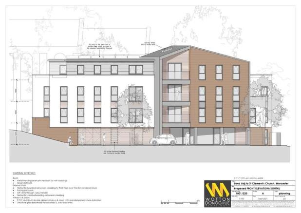
Description
The site is located south of St Clements Church, there are Victorian properties to the west of the the site that front onto Henwick Road. To the east lie a block of c. 1980's assisted living residential apartments, and to the south midrise housing that is owned by Platform Housing Association.
The site takes access from Church Walk which is accessed from St Clements Gardens. There is a footpath from the site that links to Henwick Road.
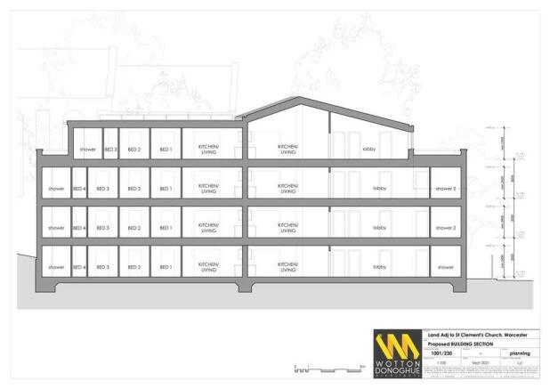
The proposals are for the erection of a four storey building comprising of 54 student beds in clusters of three, four and five bedroom apartments. On the ground floor proposed there is a indoor cycle store, laundry, plant room, reception, bin store and shared amenity space
The site is located in Worcester, 900m west of the City Centre. Worcester is a cathedral city located 30 miles south west of Birmingham, 27 miles north of Cheltenham, and 27 miles east of Hereford. At the 2021 census Worcester had a population of 103,872.
The city is served by two train stations, the closest to the subject site being Worcester Foregate Street which offers services regular to Hereford, Birmingham New, and London Paddington as well as calling at local conurbations.
The University of Worcester, with a student population on c. 9,184, is one of the fastest growing universities (according to GoStudyIn). The university is located 1km north of the subject site.
Brochures
Land at Henwick Road, Henwick Road, Worcester

NEAREST STATIONS
Distances are straight line measurements from the centre of the postcode- Worcester Foregate Street Station0.6 miles
- Worcester Shrub Hill Station1.1 miles
- Worcestershire Parkway Station3.9 miles
Notes
Disclaimer - Property reference 66F4DA4A-832D-4228-9A4C-7CA2E93CE89C. The information displayed about this property comprises a property advertisement. Rightmove.co.uk makes no warranty as to the accuracy or completeness of the advertisement or any linked or associated information, and Rightmove has no control over the content. This property advertisement does not constitute property particulars. The information is provided and maintained by Savills, Birmingham. Please contact the selling agent or developer directly to obtain any information which may be available under the terms of The Energy Performance of Buildings (Certificates and Inspections) (England and Wales) Regulations 2007 or the Home Report if in relation to a residential property in Scotland.
Map data ©OpenStreetMap contributors.