357 Acres Land At Upton, High Street, Upton, Didcot, Oxfordshire
£31.57 per sq ft
Business rates & charges may apply
- SIZE AVAILABLE
130,680-15,550,920 sq ft
12,141-1,444,729 sq m
- SECTOR
Farm land for sale
Key features
- Available as a Whole or in up to 6 Lots
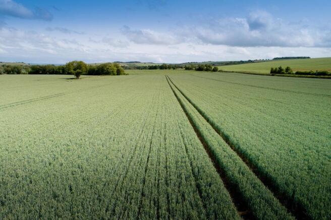
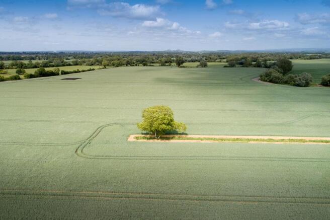
- Mixture of arable and pasture land
- Some parcels located adjacent to residential development
- Vacant possession will be available upon completion
- *INITIAL OFFERS TO BE SUBMITTED BY 5PM ON WEDNESDAY 3RD SEPTEMBER*
Description
Available as a Whole or in up to 6 Lots
Mixture of arable and pasture land
Some parcels located adjacent to residential development
Vacant possession will be available upon completion
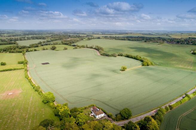
An attractive mixture of arable and pasture land located close to the village of Upton with off-lying lots in the surrounding area.
Didcot - 3 miles, Oxford - 17 miles (Distances Approximate)
In all approximately 357.08 acres (144.5 hectares)
Location
The land is located to the south of Didcot predominantly surrounding the village of Upton with all Lots being accessed via road or farm track. The majority of the land is surrounded by open countryside with some parcels neighbouring residential developments.
FOR SALE BY PRIVATE TREATY
Available as a whole or in up to 6 Lots
Lot 1 - 63.42 acres (25.66 hectares)
Two parcels of level arable land extending to approximately 63.54 acres (25.71 hectares) and currently in Winter Wheat. The land is easily accessible from the A417 via a track which runs adjacent to The Whitehouse. A right of way will be reserved for the benefit of Lot 2 along the track on the north western boundary.
Lot 2 - 219.45 acres (88.81 hectares)
An attractive ring fenced block of arable and temporary pastureland extending to approximately 219.33 acres (88.76 hectares) which is partly grazed and partly in an arable rotation. The land lies between Upton and East Hagbourne and is accessed from the A417 by way of a track which leads to a central yard area and disused former agricultural building. From this point all parcels can be accessed via a network of farm tracks.
Lot 3 - 3.23 acres (1.31 hectares)
A parcel of arable land extending to approximately 3.23 acres (1.31hectares). Access is via Chapel Furlong Road. The land immediately adjoins Upton village on its southern boundary and the village recreation ground lies to west. The field is currently in Winter Wheat.
Lot 4 - 38.58 acres (15.61 hectares)
A parcel of arable land extending to approximately 38.58 acres (15.61 hectares) which is cropped with Peas. The land is gently sloping to the south with a disused quarry area to the southeastern corner. The land is accessed along its northern boundary from Hagbourne Hill.
Lot 5 - 12.16 acres (4.92 hectares)
A parcel of arable land extending to approximately 12.16 acres (4.92 hectares) which is incorporated into the surrounding field and in an arable rotation. The parcel is easily accessed from the A417 and gently slopes northeast.
Lot 6 - 20.24 acres (8.19 hectares)
A parcel of arable land immediately to the west of the A34 accessed from the A471 at its northern boundary. The land extends to approximately 20.24 acres (8.19 hectares) and has been cropped with Winter Wheat.
Designations
The land falls within a Nitrate Vulnerable Zone. Lots 1, 4 and 6 fall within the North Wessex Downs National Landscape (AONB). Lot 6 is within a Drinking Water Safeguard Zone (Surface Water) (England).
Method of Sale
The land is available as a whole or in Lots by private treaty.
Tenure and Possession
Freehold. The land is currently tenanted. Vacant possession will be available upon completion.
Wayleaves, Easements and Rights of Way
The property is being sold subject to and with the benefit of all rights including rights of way, whether public or private, light, support, drainage, water and electricity supplies and other existing and proposed wayleaves from masts, pylons, stays, cables, drains, water and gas and other pipes whether referred to in these particulars or not. We are aware of the following rights of way across the land.
Lot 1 - Footpaths 135/17/10 and 135/13/10
Lot 2 - Footpaths 389/15/10, 389/19/10, 389/1/30
Lot 3 - Footpath 389/7/10
Sporting, Timber and Mineral Rights
Included within the sale in so far as they are owned.
Overage
In relation to Lots 3, 5 and 6, we invite offers both with and without overage proposals on an unconditional basis.
Holdover
Holdover will be required on completion for any land unharvested or needing to be baled and cleared. The extent of the holdover will be accurately defined prior to completion.
Local Authority
Lots 1,2,3,4 and 6 are located in the Vale of White Horse District Council.
Lot 5 is located in South Oxfordshire District Council.
VAT
Any guide prices quoted or discussed are exclusive of VAT. In the event that a sale of the property, or any part of it, or any right attached to it, becomes a chargeable supply for the purposes of VAT then such tax will be payable in addition.
Anti-Money Laundering
In accordance with the most recent Anti Money Laundering Legislation, the buyer will be required to provide proof of identity and address to the seller's agent once an offer has been submitted and accepted (subject to contract) prior to solicitors being instructed.
Plans & Areas
These have been prepared as carefully as possible with reference to Ordnance Survey Data but have not been professionally surveyed. The plans and photographs are for illustrative purposes only and although they are believed to be correct, their accuracy cannot be guaranteed. Please note that Lots 5 and 6 are not fenced and any fencing requirements of a Purchaser will be their responsibility.
Agents Note
One of the vendors is a consultant to Brown&Co.
Further Details
Please contact Jack Burchmore or Kevin Prince at Brown & Co Oxford Office.
Services
No services currently connected.
Viewing
PLEASE NOTE HEALTH AND SAFETY REMARKS BELOW.
During daylight hours with a copy of the Particulars, please telephone Brown & Co on to confirm time of visit.
Health and Safety
Please park safely when inspecting the land. Many of the parcels have large entrances and so parking is available. Please ensure inspections are carried out on foot and be mindful of the tenant farmers currently occupying the property.
Brochures
357 Acres Land At Upton, High Street, Upton, Didcot, Oxfordshire

NEAREST STATIONS
Distances are straight line measurements from the centre of the postcode- Didcot Parkway Station2.5 miles
- Cholsey Station4.4 miles
- Appleford Station4.4 miles
Notes
Disclaimer - Property reference 448144FH. The information displayed about this property comprises a property advertisement. Rightmove.co.uk makes no warranty as to the accuracy or completeness of the advertisement or any linked or associated information, and Rightmove has no control over the content. This property advertisement does not constitute property particulars. The information is provided and maintained by Brown&CoAdkin, Oxford. Please contact the selling agent or developer directly to obtain any information which may be available under the terms of The Energy Performance of Buildings (Certificates and Inspections) (England and Wales) Regulations 2007 or the Home Report if in relation to a residential property in Scotland.
Map data ©OpenStreetMap contributors.