
Witheridge, Tiverton

- PROPERTY TYPE
Land
- SIZE
176,854 sq ft
16,430 sq m
Key features
- Gently Sloping Farm Land
- 4.06 Acres (1.64 Hectares)
- Direct Road Access
- Short Distance from Witheridge
- For Sale by Private Treaty
- FREEHOLD
Description
Situation - The land lies in an accessible part of north Devon, near to the north / mid Devon border and with very easy access to the A361 (North Devon Link Road) at Stonelands Cross 4.6 miles away.
The village of Witheridge lies 1.2 miles to the west and the smaller settlement of Nomansland lies 3 mile to the south.
The market towns of Tiverton (11 miles) and South Molton (11.8 miles) are nearby and the A361 (North Devon Link Road) provides a direct link to the M5 motorway at Junction 27.
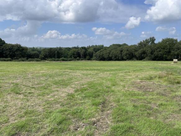
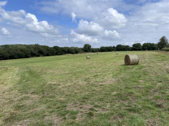
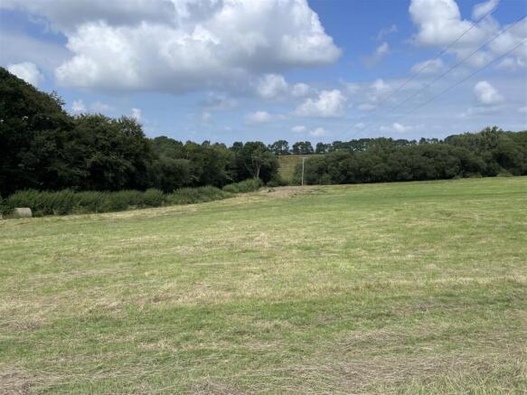
Description - The land on Betham Hill totals approximately 4.06 acres (1.64 hectares) and comprises part of a gently sloping grass field which lies at between 190 and 200 metres above sea level with a north-west facing aspect.
The land is classified as grade 3 and the soils are described as being slowly permeable seasonally wet acid loamy and clayey soils.
Services - There are no mains services connected. We are informed by the seller that a mains water connection may be available nearby.
Access - There is direct access on to the adjoining road (public highway).
Tenure - The land is owned freehold and is registered on the Land Registry. Vacant possession will be available from the completion date.
Method Of Sale - The land is offered for sale by private treaty, as one lot.
Covenant - A restrictive covenant will be placed on the land limiting its use to agricultural and equestrian purposes only and preventing the storage of scrap or other non functioning machinery on the land.
Designations - The land is within a Nitrate Vulnerable Zone (NVZ).
Local Authority - North Devon District Council.
Sporting And Mineral Rights - The sporting and mineral rights insofar as they are owned are included with the freehold.
Wayleaves & Rights Of Way - The property is sold subject to and with the benefit of any wayleave agreement and any public or private rights of way that may affect it.
There are no public rights of way passing through the land.
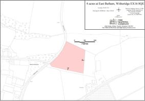
Boundary Plan - A plan which is not to scale, is included with these sale particulars for identification purposes only.
The seller will erect a new boundary fence. The responsibility for maintaining this fence will pass to the purchaser of the land from the completion date.
Viewing - Please contact Stags to arrange a viewing appointment. Tel: . Email: .
Directions - From Witheridge proceed east out of the village on North Street signed towards Witheridge and after a short distance follow the road around to the left towards Rackenford (on Rackenford Road). After approximately 1 mile, at Pilliven Cross, follow the road around to the left and the entrance into the land will be found on the right after 0.2 miles.
What3words - Reference/// koala.decks.modifies
Disclaimer - These particulars are a guide only and are not to be relied upon for any purpose.
Brochures
Witheridge, TivertonWitheridge, Tiverton

NEAREST STATIONS
Distances are straight line measurements from the centre of the postcode- Lapford Station7.5 miles


Notes
Disclaimer - Property reference 34065746. The information displayed about this property comprises a property advertisement. Rightmove.co.uk makes no warranty as to the accuracy or completeness of the advertisement or any linked or associated information, and Rightmove has no control over the content. This property advertisement does not constitute property particulars. The information is provided and maintained by Stags, Exeter. Please contact the selling agent or developer directly to obtain any information which may be available under the terms of The Energy Performance of Buildings (Certificates and Inspections) (England and Wales) Regulations 2007 or the Home Report if in relation to a residential property in Scotland.
Map data ©OpenStreetMap contributors.