Bells Lane, Lydiate, Liverpool, L31
- PROPERTY TYPE
Land
- SIZE
Ask agent
Key features
- FOR SALE BY INFORMAL TENDER
- TENDER DATE - 12 NOON WEDNESDAY, 3RD SEPTEMBER 2025
Description
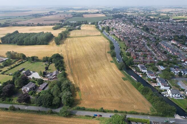
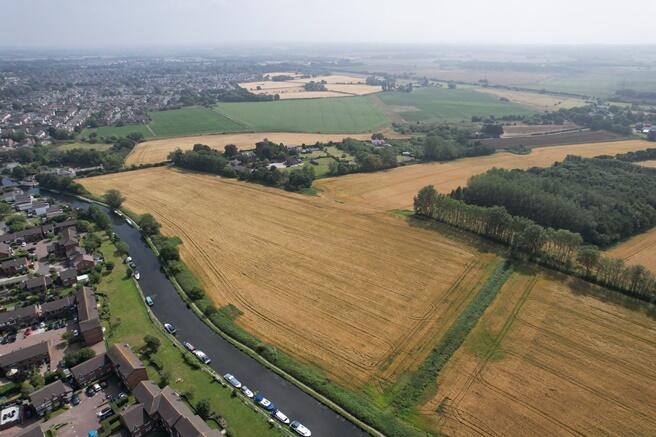
The land is conveniently positioned in a rural yet easily accessibly area on the outskirts of Lydiate and is well connected with the A59 three minutes away. The land can be accessed directly off Bell's Lane. The location of the land is shown on the location plan on the reverse of this sale brochure or can be located using postcode L31 4EN.
Description
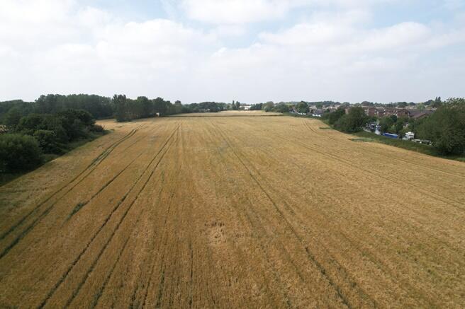
For sale as a whole, the land comprises 3.84 hectares (9.5 acres) or thereabouts of agricultural land currently used for arable cropping. The land is designated as Grade 1 on the Agricultural Land Classification Map for England and Wales.
Boundaries
The boundaries of the land are hedges/trees.
Rights of Way/Easement/Wayleave
The property is sold with the benefit of and subject to all existing rights of way, covenants, easements and wayleaves and the like.
Access
The land enjoys road frontage onto Bells Lane and could be accessed directly off Bells Lane if the existing access was widened noting that the existing access serves land in separate ownership.
Clawback and Overage
The sale of the land will be subject to Overage provisions. The Overage provisions will subsist for 25 years from the date of the sale. The trigger event for the Overage will be a Planning Consent or Planning Consents for any non-agricultural use with 25% of the uplift between the base value and the enhanced value being paid to the vendors or their successors in title. The base value will be calculated as being the value of the land subject to the trigger event assuming that Planning Consent could not be obtained, the enhanced value is the value of the same trigger event with the benefit of the Planning Consent. The Overage payable will be 25% of the difference between the base and the enhanced value. Precise terms to be drafted by the vendor's solicitor.
Planning
The local authority is Sefton Council. Sefton Council's Local Plan, adopted in 2017, designates the subject land in the Green Belt, policy MN7.
Tenure
The land is sold with the benefit of vacant possession, subject to a cropping licence expiring on 31st March 2026.
Method of Sale
The land is offered for sale by informal tender and all prospective purchasers should complete and return the attached tender form to P Wilson and Company, no later than 12 noon on Wednesday, 3rd September 2025. The landlords reserve the right to not necessarily accept any or the highest bid.
Viewing and Health and Safety
The prospective purchaser may view the land on foot and without appointment as long as they do so in normal daylight hours. Prospective purchasers are respectively reminded not to damage any growing crops in viewing property and that they should take all reasonable precautions and observe necessary health and safety procedures in viewing the property. The vendors for themselves and P Wilson & Company as their agents accept no liability for any health and safety issue arising out of the viewing of the property.
Brochures
Tender FormSales ParticularsBells Lane, Lydiate, Liverpool, L31

NEAREST STATIONS
Distances are straight line measurements from the centre of the postcode- Maghull North Station1.5 miles
- Maghull Station1.6 miles
- Town Green Station2.5 miles
Notes
Disclaimer - Property reference 860-land-off-bells-lane. The information displayed about this property comprises a property advertisement. Rightmove.co.uk makes no warranty as to the accuracy or completeness of the advertisement or any linked or associated information, and Rightmove has no control over the content. This property advertisement does not constitute property particulars. The information is provided and maintained by P Wilson & Company, Preston. Please contact the selling agent or developer directly to obtain any information which may be available under the terms of The Energy Performance of Buildings (Certificates and Inspections) (England and Wales) Regulations 2007 or the Home Report if in relation to a residential property in Scotland.
Map data ©OpenStreetMap contributors.