Land at Thurstonfield, Carlisle, Cumbria
- PROPERTY TYPE
Land
- SIZE
Ask agent
Key features
- 137.69 Acres (55.72 Ha) of Agricultural Land
- Offered for sale as a whole or in 5 lots
- For sale by Informal Tender
- Closing date for Tenders Wednesday 8th October 2025, by 12 noon
Description
The sale of this land is a unique opportunity for interested parties to purchase agricultural land close to Thurstonfield. The village is situated approximately six miles west of Carlisle and is one of six villages on the Solway Plain within the designated Area of Outstanding Natural Beauty (AONB).
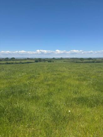
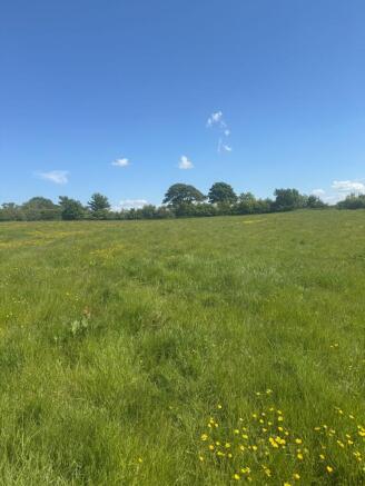
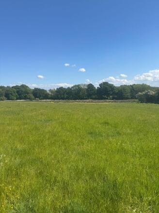
The land totals 137.69 Acres (55.72 Ha) and is available as a whole or in five lots.
The land is all in grass and is classified as Grade 3 on the Soil Survey of England & Wales, the soils are classified as freely draining slightly acid loamy soils and seasonally wet slightly acid but base-rich loamy and clayey soils.
Lot 1 (shaded orange)
45.05 Acres (18.23 Ha), currently in grass. The lot is made up of two fields with a lonning dividing the two. The fields are gently undulating with the easternmost field dropping away to the south. Access is via the lonning either from the north or via Thurstonfield to the south.
Lot 2 (shaded purple)
22.46 Acres (9.09 Ha), currently in grass. The Lot is made up of four fields and has the benefit of access from the council road to the east and the unmade lonning to the west.
Lot 3 (shaded green)
20.07 Acres (8.12 Ha), currently in grass. The land drops away towards the brook and woodland to the east. Access is via the lonning which runs from Thurstonfield village towards Burgh by Sands.
Lot 4 (shaded blue)
10.84 Acres (4.39 Ha) currently in grass, the field is accessed directly from the B5307.
Lot 5 (shaded red)
39.27 Acres (15.90 Ha), part in grass part uncultivated. The land is split in to three parcels, two have road frontage with the smallest field, to the south of the road, being accessed via an unmade track.
Site Special Scientific Interest
The land is all within an area designated as SSSI.
Nitrate Vulnerable Zone
The land is located within the Nitrate Vulnerable Zone as designated by DEFRA.
Rights of Way and Easements
A public footpath follows the eastern boundary of the westernmost field of Lot 5. Access to the southernmost parcel of Lot 5 is over an unmade track with the field having the benefit of a right of way.
Access to Lot 1, the east side of Lot 2 and Lot 3 is via the lonning. Whilst this is unsurfaced it is adopted by the Local Authority.
The property is sold subject to and with the benefit of all rights including rights of way, whether public or private, light, support, drainage, water, telephone and electricity supplies and other rights and obligations, easements, quasi-easements and restrictive covenants, and all existing and proposed wayleaves or masts, pylons, stays, cable, drains and water, gas or other pipes, whether referred to in the Sales Particulars or not, and to the provisions of any Planning Scheme or County or Local Authorities without obligations on the part of the Sellers or their agents to specify them.
Method of Sale
For sale by Informal Tender. Tenders are to be submitted in writing, on the required form, to the Agents’ office by no later than midday on Wednesday 8th October 2025. Please note that the Vendors reserve the right not to accept the highest, or any, tender.
Potential Contamination
We are aware that the current owner is in a dispute with an agro-chemical company in relation to products applied to the land which he believes have caused detriment to the soil. We, as selling Agents, only have very limited information about this and potential buyers must make their own enquiries and satisfy themselves.
Services
Water is connected to several parcels, buyers will be required to make their own investigations regarding these connections. If in doubt it should be assumed that no water is available and buyers will be required to make their own connection.
We are advised that the above services are available. Neither Barbers Rural nor PFK have tested any apparatus, equipment, fittings etc or services to this property so cannot confirm that they are in working order. A buyer is recommended to obtain confirmation from their solicitor or surveyor.
Tenure
We are advised that the property is freehold with vacant possession on completion. This will be confirmed by solicitors.
Local Authority
Cumberland Council, Civic Centre, Rickergate, Carlisle, CA3 8QG
Viewing
Viewing of the land is permitted during any daylight hour provided a copy of these particulars is to hand. Please do not obstruct any gateways or the public highway or any property belonging to a third party whilst viewing the land. All viewings are to be undertaken on foot on all occasions. No vehicular access is to be taken to the land. Further information can be gained from either of the Joint Selling Agents:
PFK Rural on or .
Barbers Rural on or .
Location
Postcode (centre of village) CA5 6HG
What3words (centre of village) ///peach.craftsmen.smart
Brochures
Land at ThurstonfieldLand at Thurstonfield, Carlisle, Cumbria

NEAREST STATIONS
Distances are straight line measurements from the centre of the postcode- Dalston Station5.4 miles
- Wigton Station6.4 miles
Notes
Disclaimer - Property reference 396b6ee1-1fa5-454d-9d27-a048c95bd0ba. The information displayed about this property comprises a property advertisement. Rightmove.co.uk makes no warranty as to the accuracy or completeness of the advertisement or any linked or associated information, and Rightmove has no control over the content. This property advertisement does not constitute property particulars. The information is provided and maintained by PFK, Penrith. Please contact the selling agent or developer directly to obtain any information which may be available under the terms of The Energy Performance of Buildings (Certificates and Inspections) (England and Wales) Regulations 2007 or the Home Report if in relation to a residential property in Scotland.
Map data ©OpenStreetMap contributors.