Kingskettle, Cupar, Fife

- PROPERTY TYPE
Land
- SIZE
5,445,000 sq ft
505,858 sq m
Description
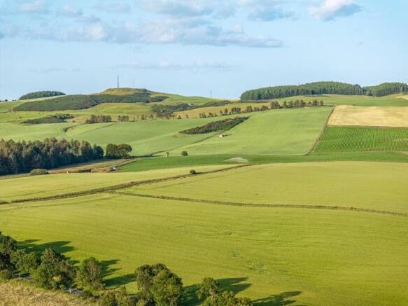
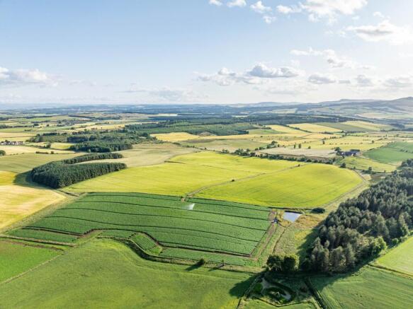
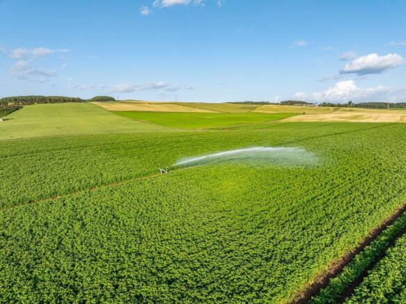
The land extends to approximately 125 acres (50.48 hectares) in total and comprises 9 field enclosures, 5 of which are utilised for arable
cropping with the remainder in grass. Grass fields are fenced and have access to water. The land
rises from 105 to 135 metres above sea level and is predominantly classified as grade 3.1 by the
James Hutton Institute with a small area of grade 4.2 land to the south-western boundary.
In terms of cropping history, please refer to the table within the sales brochure (page 4) where you will find a summary of the last three years' cropping.
The land is easily accessed from the public road that bisects the property and from field to field. Watering and irrigation are available to a number
of fields from a network of ditches and irrigation ponds. Please note it is the vendors’ intention to retain rights to extract water from the Irrigation Pond in field 9 in order to irrigate land being retained at Rameldry. This right will include
rights of access and the use of associated infrastructure, including but not limited to pipework, for the movement of water as required.
BASIC PAYMENT SCHEME
These are not included in the sale.
TIMBER, MINERAL AND SPORTING RIGHTS
The timber, mineral and sporting rights are included in the sale, insofar as they are owned.
The land is located a short distance from the village of Kettlebridge in central Fife, approximately halfway between the towns of Glenrothes and Cupar, nestled within rolling
countryside and fertile soils in an area renowned for its agricultural productivity. Once the county
town of Fife, Cupar (7.5 miles) is a charming and historic town situated in the Howe of Fife. The
market town provides an extensive range of shops, supermarkets, entertainment, culture, education,
professional services, and health facilities. Glenrothes (7 miles), Scotland’s first new town, is central to the region and is well connected to other major Scottish cities.
Brochures
Web DetailsParticularsKingskettle, Cupar, Fife

NEAREST STATIONS
Distances are straight line measurements from the centre of the postcode- Ladybank Station2.6 miles
- Springfield Station4.0 miles
- Markinch Station3.2 miles
Notes
Disclaimer - Property reference SFA250041. The information displayed about this property comprises a property advertisement. Rightmove.co.uk makes no warranty as to the accuracy or completeness of the advertisement or any linked or associated information, and Rightmove has no control over the content. This property advertisement does not constitute property particulars. The information is provided and maintained by Strutt & Parker, Scottish Estates & Farm Agency. Please contact the selling agent or developer directly to obtain any information which may be available under the terms of The Energy Performance of Buildings (Certificates and Inspections) (England and Wales) Regulations 2007 or the Home Report if in relation to a residential property in Scotland.
Map data ©OpenStreetMap contributors.