Bower Road, Mersham, Ashford, Kent, TN25
- PROPERTY TYPE
Land
- SIZE
1,121,670 sq ft
104,207 sq m
Key features
- For sale as a whole
- Farmland with lane frontage
- Divided into two parts
- Interesting landscape features
Description
#TheGardenOfEngland
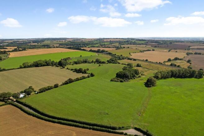
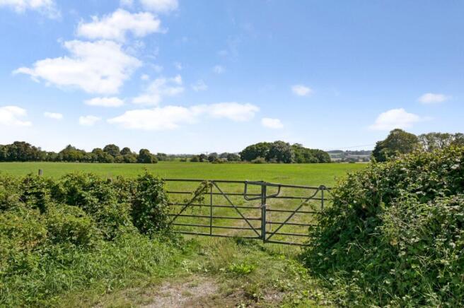
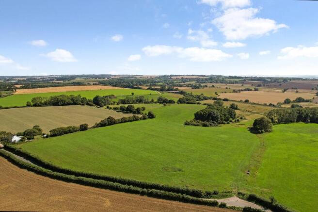
A block of farmland located just outside Mersham village which is divided into 2 parts. The land has lane frontage and access to Bower Road and is principally pastureland with some interesting landscape features.
Viewers are requested to not leave gates open when they view and respect the presence of any livestock that are grazing.
About 25.75 acres
Guide Price £225,000 to £250,000
Method of Sale
The land is offered for sale by Private Treaty with offers invited. However, in the event of competing offers, interested parties may be asked to submit their “best and final” offer. The seller also reserves the right to offer the land by informal tender or auction if the need arises.
The Land
The land is divided into two parts. The northern parcel of land is the largest and this extends to about 21.30 acres and includes a small copse of trees in the middle of this parcel. The southern parcel of land lies to the south of the railway line and extends to about 4.45 acres and is accessed through the underpasses under the High Speed/Eurotunnel and the Dover to Ashford railway lines.
Telecom Mast
An agreement has been entered into for a telecommunication mast to be constructed on the land, this was dated 10th May 2023 and is to be located close to the western boundary about midway down the larger part of the land with the access running close to the western boundary. The initial agreement is for 10 years and is with EE Limited at an annual payment of £1500 per annum.
However, they have not yet constructed or equipped the mast for use. A copy of the lease is available on request from Hobbs Parker Estate Agents LLP.
Soil Type
The upper part of the land is shown as being Soilscape 7 on the ‘’LandIS Soilscape Map’’ and the lower part of the land is shown as Soilscape 18.
For further information go to:
Footpaths
There is a very short section of footpath (Footpath No AE373) in the south west corner of the large parcel of land where you pass under the bridge to the southern parcel. Footpath No AE376 crosses the small parcel of land to the south of the railway line. For further details of footpaths and public rights of way nearby visit:
Fencing
The western boundary of the northern part of the land is currently unfenced but the sellers are making arrangements.
Third Party Connections
One of the Trustees of the Charitable Trust selling the land is related to a Director of Hobbs Parker Estate Agents LLP.
Plans/Boundaries & Acreages
The plan on these sales particulars and the acreage quoted are based on the latest Ordnance Survey mapping and therefore are strictly for identification and guidance only. Interested parties are reminded that the land is sold in accordance with the sellers Land Registry Title plan/s, and they must satisfy themselves as to the accuracy of boundaries and the quantity of land being purchased.
The plans are published for illustrative purposes only and although they are believed to be correct their accuracy cannot be guaranteed. Any error or mistake shall not annul the sale or entitle any party to compensation thereof.
Planning/Local Authority
All planning enquiries relating to any future use of the land should be directed to the planning department at Ashford Borough Council (ashford.gov.uk).
Services
There are no mains services currently connected. It is believed that water is available for connection in Bower Road but interested parties are advised to make their own enquiries with the relevant utility providers to confirm this.
Viewings/Health & Safety
Viewings are to take place on an unaccompanied basis during daylight hours, but these are strictly by appointment through Hobbs Parker Estate Agents. Viewers are asked to contact Hobbs Parker at or on with their full address, contact details & vehicle registration number informing us of when you intend to view.
Viewers are asked to exercise extreme caution when viewing, especially when climbing over the locked gate, and must have regard for their own safety during their inspection. The vendors and their agents do not accept any responsibility for any accident or injury because of your inspection of the property.
Our Ref: AEA250057
Brochures
ParticularsBower Road, Mersham, Ashford, Kent, TN25
NEAREST STATIONS
Distances are straight line measurements from the centre of the postcode- Ashford Station3.4 miles
- Ashford International Station3.4 miles
- Westenhanger Station4.5 miles


Notes
Disclaimer - Property reference AEA250057. The information displayed about this property comprises a property advertisement. Rightmove.co.uk makes no warranty as to the accuracy or completeness of the advertisement or any linked or associated information, and Rightmove has no control over the content. This property advertisement does not constitute property particulars. The information is provided and maintained by Hobbs Parker Estate Agents, Ashford. Please contact the selling agent or developer directly to obtain any information which may be available under the terms of The Energy Performance of Buildings (Certificates and Inspections) (England and Wales) Regulations 2007 or the Home Report if in relation to a residential property in Scotland.
Auction Fees: The purchase of this property may include associated fees not listed here, as it is to be sold via auction. To find out more about the fees associated with this property please call Hobbs Parker Estate Agents, Ashford on 01233 542521.
*Guide Price: An indication of a seller's minimum expectation at auction and given as a “Guide Price” or a range of “Guide Prices”. This is not necessarily the figure a property will sell for and is subject to change prior to the auction.
Reserve Price: Each auction property will be subject to a “Reserve Price” below which the property cannot be sold at auction. Normally the “Reserve Price” will be set within the range of “Guide Prices” or no more than 10% above a single “Guide Price.”
Map data ©OpenStreetMap contributors.


