Churchstanton, Taunton
- PROPERTY TYPE
Land
- SIZE
548,420 sq ft
50,950 sq m
Key features
- Natural Farm Land
- 12.59 Acres (5.10 Hectares)
- Direct Road Access
- An Abundance of Natural Water
- Diverse & Historic Habitat
- For Sale by Private Treaty
- FREEHOLD
Description
Situation - The land is situated in the heart of the Blackdown Hills Area of Outstanding Natural Beauty (AONB), within the parish of Churchstanton and 1.1 miles to the west of Churchinford. The village of Hemyock lies 4.3 miles to the west and sits on the River Culm with the towns of Taunton and Wellington both 9 miles away to the north.
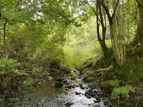
History & Description - The name, ‘The Gathering Grounds’, comes from when the land was purchased in the 1950’s by the waterboard for the thousands of litres of water that spring from every part of the land all year round. Sadly, even after putting in a sewage works for the surrounding properties, the water could not be purified sufficiently for drinking water, both waterworks were abandoned and the land began to reclaim itself. Now every property has it's own treatment and the river runs clear enough for the watercress to grow.
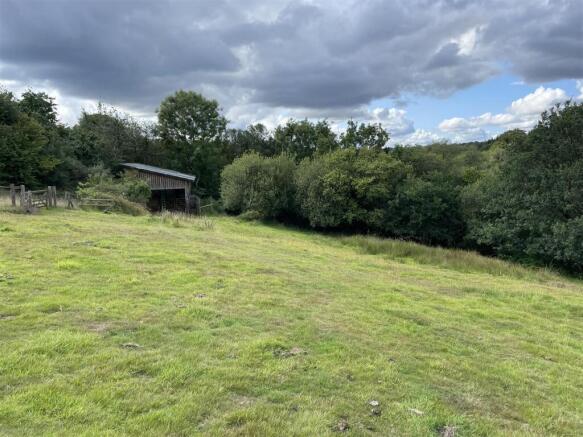
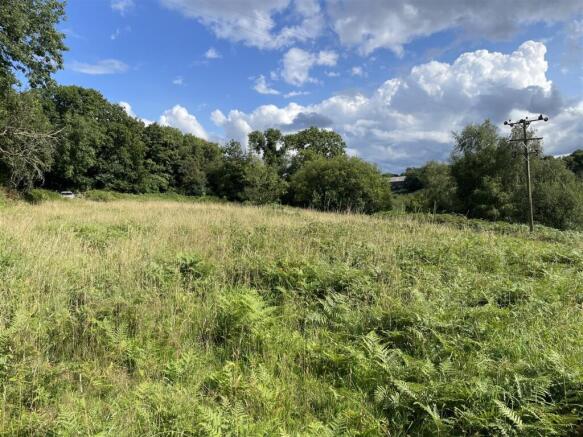
The land extends to approximately 12.59 acres (5.10 hectares) and comprises a mixed area of open pasture, rush pasture and wooded areas with streams flowing through and is an idyllic nature reserve, managed mainly by hand and with the grazing of Riggit Galloway cattle.
There is a POLE BARN (approximately 12m x 6m) which is used for storage (non-livestock) and there are three separate points of access into the land.
The land includes steep flintstone and greensand banks, silty, welly deep bogs and fens full of tussocks. During the spring months the bluebells will carpet every dappled spot and Early Dog Violets, Cuckoo Flowers and King cups will then give way to Cut Leaved Cranesbill, Bird’s foot Trefoil and orchids, then it’s ragged robin, Knapweed, yarrow and Devil’s Bit Scabious. All these in large part to the gentle grazing of a small herd of cattle, who keep the grasses from felting an impenetrable layer of thatch.
Services - There are no mains services connected to the land. Natural water is available from springs and streams.
Access - There is direct access from the public highway at two points: a gate on the northern boundary and a gate on the western boundary.
There is also a right of access (at all times and for all purposes) over a neighbour's paddock on the southern boundary (10 foot wide).
Method Of Sale - The land is offered for sale by private treaty, as one lot.
Tenure - The land is owned freehold and is registered on the Land Registry.
Designations & Land Management - The land is within the Blackdown Hills AONB and is not within a Nitrate Vulnerable Zone (NVZ).
The land is managed within a Higher Level Scheme.
Covenant - There is a historic restrictive covenant on the land which states that the land must only be used as a nature reserve.
Planning - Planning consent was approved for for the erection of an agricultural building for storage of machinery, winter feed and hay, cattle handing equipment and cattle crush on 26th November 2020 (Reference: 10/20/0019/AGN).
Local Authority - Somerset Council (Somerset West and Taunton).
Sporting And Mineral Rights - The sporting and mineral rights insofar as they are owned are included with the freehold.
Wayleaves & Rights Of Way - The property is sold subject to and with the benefit of any wayleave agreement and any public or private rights of way that may affect it.
There are no public rights of way passing through the land.
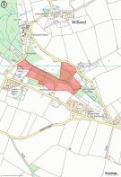
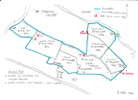
Boundary Plan - A plan which is not to scale, is included with these sale particulars for identification purposes only.
Viewing - Viewings are strictly by prior appointment with Stags. Please call or email: to arrange an appointment.
Directions - From the centre of Churchinford, proceed towards Hemyock on Red Lane. Continue to the crossroads and continue straight across towards Hemyock. After 0.25 miles take the right fork (unsuitable for heavy goods vehicles) and the entrance gate into the land will be found on the right after 0.3 miles.
What3words - /// riches.worms.mailings
Disclaimer - These particulars are a guide only and are not to be relied upon for any purpose.
Warning - Farms and land can be dangerous places. Please take care when viewing the property, particularly in the vicinity of farm buildings and livestock.
Brochures
Churchstanton, TauntonChurchstanton, Taunton
NEAREST STATIONS
Distances are straight line measurements from the centre of the postcode- Taunton Station8.0 miles
Notes
Disclaimer - Property reference 34129670. The information displayed about this property comprises a property advertisement. Rightmove.co.uk makes no warranty as to the accuracy or completeness of the advertisement or any linked or associated information, and Rightmove has no control over the content. This property advertisement does not constitute property particulars. The information is provided and maintained by Stags, Exeter. Please contact the selling agent or developer directly to obtain any information which may be available under the terms of The Energy Performance of Buildings (Certificates and Inspections) (England and Wales) Regulations 2007 or the Home Report if in relation to a residential property in Scotland.
Map data ©OpenStreetMap contributors.
