
Lower Dunsforth, York, North Yorkshire, YO26
- PROPERTY TYPE
Land
- SIZE
Ask agent
Description
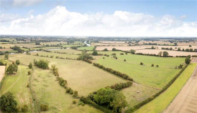
The land at Scarers Lane is situated approximately 0.5 mile to the south-east of the village of Lower Dunsforth which itself is situated approximately 4 miles to the south-east of the market town of Boroughbridge and 16 miles to the north-west of the city of York. Access to the A1(M) is within 4 miles which connects the service centres of the north-east.
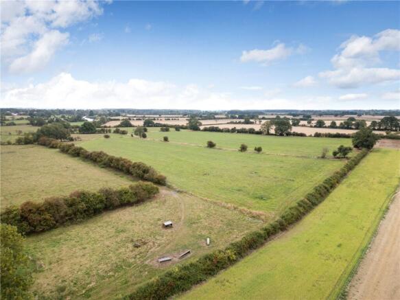
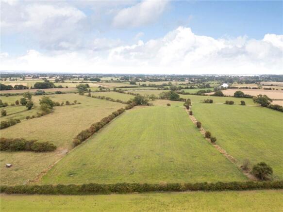
Land
The property comprises a ring-fenced parcel of productive meadow and pasture land with frontage to the River Ure and extending in all to approximately 63.89 acres which comprises approximately 22.69 acres of improved grassland and 41.20 acres of pasture land.
The land is all classified as being Grade 3 under the former MAFF Land Classification Series.
The underlying soil type is classed as being part of the Foggathorpe series which is described as a slowly permeable, loamy and fine loamy over clayey soil and summarised as being suited to cereal cropping, dairying and stock rearing.
The land is generally level being situated approximately 20 metres above sea level. The boundaries predominantly comprise mature hedgerow interspersed with timber post and wire fencing forming livestock proof boundaries.
The land is accessed directly from the adopted highway known as Scarers Lane with a public footpath transecting the land connecting Scarers Lane with the banks of the River Ure where the footpath continues north.
Method of sale
The property is offered for sale by private treaty as a whole. The vendors reserve the right to conclude the sale by any other means at their discretion.
If you have downloaded these particulars, please register your interest with the selling agent.
Tenure & Possession
The freehold of the Property is offered for sale subject to a Farm Business Tenancy (FBT) which is due to expire on 9th September 2026.
Services
The land is not connected to any mains services.
Wayleaves Easements & Rights of Way
The land is sold subject to and with the benefits of all rights of way, water drainage, water courses and other easements and rights of adjoining owners (if any) affecting the same and all existing and proposed wayleaves and other matters registered by any competent authority subject to statute.
Health & Safety
Parties are reminded to be as vigilant as possible when making an inspection and be aware of potential hazards including open ditches and drains. Parties viewing the property do so, entirely at their own risk.
VAT
Any prices quoted are exclusive of VAT. In the event that the sale of the property or any part of it or any right attached to it becomes a chargeable supply for the purposes of VAT, such tax will be payable in addition to the purchase price.
Sporting, Fishing, Timber & Mineral Rights
The sporting, fishing, timber and mineral rights are included in so far as they are owned.
Local Authorities
North Yorkshire Council
Viewings
Parties are permitted to view the land on foot and during reasonable daylight hours.
Directions
From Boroughbridge, travel south on the B6265. After approx. 2.5 miles turn left onto Hunday Field Road signposted Lower Dunsforth. Continue through the village of Lower Dunsforth following Beck Closes Road for approx. 0.3 mile before turning left onto the no-through road signposted Dunsforth Lodge. The land is situated after approximately 0.4 mile marked with a Carter Jonas For Sale board.
What3Words
///keyboard.nicknames.pets
Brochures
ParticularsLower Dunsforth, York, North Yorkshire, YO26

NEAREST STATIONS
Distances are straight line measurements from the centre of the postcode- Cattal Station5.0 miles

Notes
Disclaimer - Property reference HGT250030. The information displayed about this property comprises a property advertisement. Rightmove.co.uk makes no warranty as to the accuracy or completeness of the advertisement or any linked or associated information, and Rightmove has no control over the content. This property advertisement does not constitute property particulars. The information is provided and maintained by Carter Jonas Rural, Yorkshire. Please contact the selling agent or developer directly to obtain any information which may be available under the terms of The Energy Performance of Buildings (Certificates and Inspections) (England and Wales) Regulations 2007 or the Home Report if in relation to a residential property in Scotland.