

Land for sale
Land At Rock Farm, Sutton Scarsdale, Chesterfield, Derbyshire, S44

- PROPERTY TYPE
Land
- SIZE
2,333,074 sq ft
216,750 sq m
Key features
- Productive arable land with rolling topography
- Land is classified as grade 4 land
- Good road connections to M1
- Approximately 53 acres in total
- Available as a whole or in 3 lots
- EPC Rating = E
Description
Description
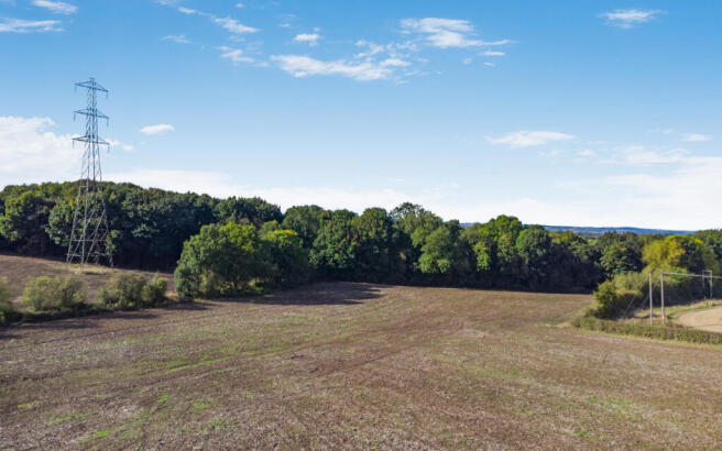
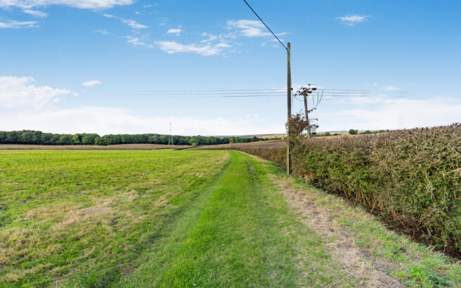
Rock Farm is a productive arable farm set within a ring fence. The farm is situated outside the desirable village of Sutton Scarsdale with excellent road connections to Junction 29 of the M1. The house sits in the centre of the land with excellent vistas across open countryside.
The farmland across Lot 2 extends to approximately 53.56 acres (21.67 hectares) in total.
Over the last four years the land has been left fallow, it has now been cultivated and worked enabling a good entry for a spring crop or alternatively seeded to grass.
As with a lot of land in the local area, it has previously been open cast mined and subsequently restored. The land is classified as grade 4 on the provisional agricultural land classification. When it was previously cropped it was productive land capable of growing a wide variety of
combinable crops.
The fields are divided by mature hedgerows that provide a habitat for a wide range of species. The land rises to the south and undulates across the farm. The land is under drained with a new scheme having been laid on restoration of the land with the vendors improving this over the years, under their ownership.
Location
The farm is located outside the village of Sutton Scarsdale in a desirable part of Derbyshire with excellent road and rail connections locally. The farm is approximately 4 miles to the east of the large town of Chesterfield and 5 miles to the south of the attractive and renowned market town of Bolsover.
Chesterfield has a wide range of amenities including, supermarkets, schools and a number of restaurants.
There are regular trains from Chesterfield to London St Pancras with fast trains from 1 hour and 50 minutes. Junction 29 of the M1 lies approximately 3 miles to the south and provides access to the north and south of the UK.
Disclaimer: All journey times and distances are approximate.
Acreage: 53.56 Acres
Directions
Post Code S44 5ST
what3words ///brambles.hacking.storybook
Additional Info
Viewing: Strictly by appointment with the selling agents.
Local Authority: North East Derbyshire District Council
Photos: September 2024
Particulars: October 2024
Brochures
Web DetailsLand At Rock Farm, Sutton Scarsdale, Chesterfield, Derbyshire, S44

NEAREST STATIONS
Distances are straight line measurements from the centre of the postcode- Chesterfield Station3.1 miles

Notes
Disclaimer - Property reference LIR250115. The information displayed about this property comprises a property advertisement. Rightmove.co.uk makes no warranty as to the accuracy or completeness of the advertisement or any linked or associated information, and Rightmove has no control over the content. This property advertisement does not constitute property particulars. The information is provided and maintained by Savills Rural Sales, Lincoln. Please contact the selling agent or developer directly to obtain any information which may be available under the terms of The Energy Performance of Buildings (Certificates and Inspections) (England and Wales) Regulations 2007 or the Home Report if in relation to a residential property in Scotland.
Map data ©OpenStreetMap contributors.