Replacement Dwelling at Moat Farm, Parliament Heath, Groton, Suffolk
- PROPERTY TYPE
Plot
- BEDROOMS
4
- BATHROOMS
3
- SIZE
2,291 sq ft
213 sq m
Description
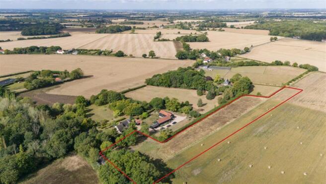
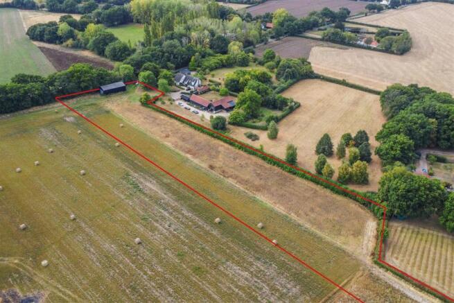
The subject land to be conveyed currently forms part of an established arable farm discreetly located in the rural parish of Groton.
Planning
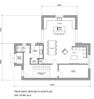
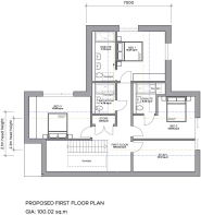
Following prior approval for residential conversion of an existing steel frame and clad agricultural barn, full planning permission has now been granted for its demolition for a replacement, two storey detached dwelling covering a gross internal area of some 213 sq.m (2,291 sq.ft).
The approved detached house will comprise – hall and inner hall, cloak room, open plan kitchen / dining room / living room, utility room, snug, galleried landing, three double bedrooms (two with ensuite shower rooms) a further bedroom / study and a family bathroom.
The permission also grants repositioning of the proposed dwelling further north-east into its approved 0.37-acre residential curtilage, where the existing structure is ‘hard’ on its south-western boundary. This will significantly improve the dwellings’ overall position in the site. Please refer to the architects proposed site plan.
Included in the sale is a further 2.48 acres of amenity land (totalling 2.85 acres) as edged red on the accompanying site plan. This additional land is still designated as agricultural use, and to extend the residential curtilage would require a further planning application.
The full planning notice with 18 conditions, Design & Access Statement and associated site and floor plans are available via the Babergh & Mid Suffolk’s planning portal ( under reference DC/24/04501
Agents Note
A further 3 acres of adjacent land is available by separate negotiation.
Groton is a sporadic rural village with the parish Church and a village pub - The Fox & Hounds. Just over two miles from the property is the village of Boxford, which has village amenities including a primary school, two pubs, village hall and a number of shops for everyday needs.
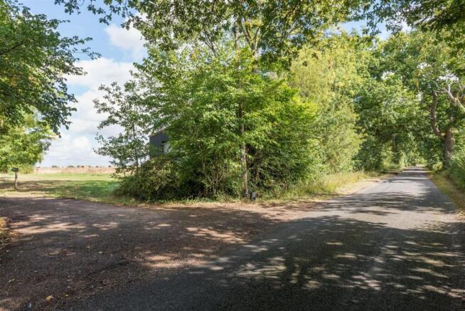
Access
A minor county lane leads onto a part shared driveway, which then leads onto the site. Successors will be granted a formal right of way over the front section of the drive and will thus pay an equal contribution to its maintenance hereafter.
Mandatory Biodiversity Net Gain
The areas shaded pink on the architects proposed site plans denote land reserved for the mandatory plantation of a traditional orchard, which covers 0.37 acres / 1,500sq.m.
Community Infrastructure Levy (CIL Liability)
A CIL payment can apply; however, self-builders are exempt but must remain in residence for a minimum period of 3 years from completion. The charge is based on an indexed calculation of £115 per sq.m of the entire proposed floor area.
Further Obligations and Considerations
The discharge of all planning conditions and any unilateral undertakings.
Flood Risk
The site entirely lies within Flood Zone 1, which has the lowest risk of fluvial flooding.
Services
Mains water and electricity are close by but require connection. We anticipate a biological sewage treatment plant will be installed for foul drainage.
Brochures
BrochureReplacement Dwelling at Moat Farm, Parliament Heath, Groton, Suffolk

NEAREST STATIONS
Distances are straight line measurements from the centre of the postcode- Sudbury Station5.6 miles
Notes
Disclaimer - Property reference 34154266. The information displayed about this property comprises a property advertisement. Rightmove.co.uk makes no warranty as to the accuracy or completeness of the advertisement or any linked or associated information, and Rightmove has no control over the content. This property advertisement does not constitute property particulars. The information is provided and maintained by Chapman Stickels, Hadleigh. Please contact the selling agent or developer directly to obtain any information which may be available under the terms of The Energy Performance of Buildings (Certificates and Inspections) (England and Wales) Regulations 2007 or the Home Report if in relation to a residential property in Scotland.
Map data ©OpenStreetMap contributors.