Lawfield Lot 11 Steading Strip, Dalkeith, Midlothian, EH22
- PROPERTY TYPE
Land
- SIZE
71,003 sq ft
6,596 sq m
Description
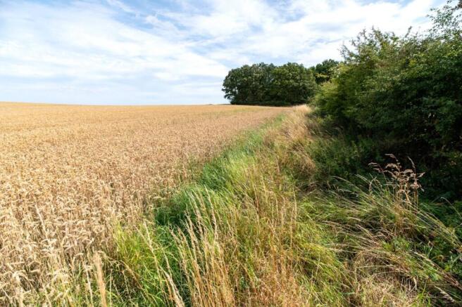
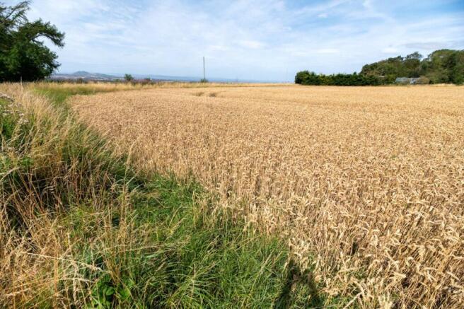
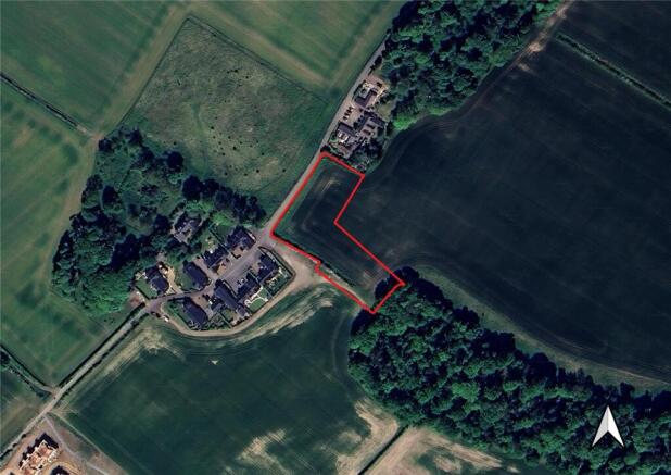
A compact 1.63 L-shaped strip of arable grade land located within the traditional Lawfield Steading, offering excellent small-scale amenity use for paddock and equestrian use. The land benefits from an elevated location with views across the Lothians.
Access via private road to Lawfield Farm Steading.
**CLOSING DATE - THURSDAY 23rd OCTOBER at NOON**
A compact 1.63 L-shaped strip of arable grade land located within the traditional Lawfield Steading, offering excellent small-scale amenity use for paddock and equestrian use. The land benefits from an elevated location with views across the Lothians.
Access via private road to Lawfield Farm Steading.
Brochures
ParticularsLawfield Lot 11 Steading Strip, Dalkeith, Midlothian, EH22

NEAREST STATIONS
Distances are straight line measurements from the centre of the postcode- Eskbank Station2.1 miles
- Newtongrange Station1.7 miles
- Shawfair Station3.4 miles
About Davidson & Robertson, Edinburgh
The Rural Centre West Mains Ingliston Edinburgh EH28 8LT

Notes
Disclaimer - Property reference EDI250025. The information displayed about this property comprises a property advertisement. Rightmove.co.uk makes no warranty as to the accuracy or completeness of the advertisement or any linked or associated information, and Rightmove has no control over the content. This property advertisement does not constitute property particulars. The information is provided and maintained by Davidson & Robertson, Edinburgh. Please contact the selling agent or developer directly to obtain any information which may be available under the terms of The Energy Performance of Buildings (Certificates and Inspections) (England and Wales) Regulations 2007 or the Home Report if in relation to a residential property in Scotland.
Map data ©OpenStreetMap contributors.