Residential development for sale
West End Lane, Esher, Surrey, KT10
£879.02 per sq ft
Business rates & charges may apply

- SIZE AVAILABLE
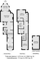
1,587 sq ft
147 sq m
- SECTOR
Residential development for sale
Key features
- Freehold Development Opportunity
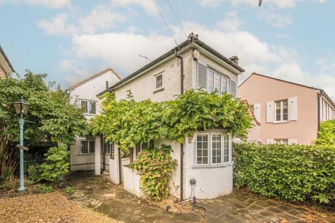
- Four-Bedroom Detached House
- Large Garden
- Located in West End Village, Esher
- Off-Street Parking
Description
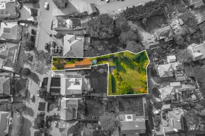
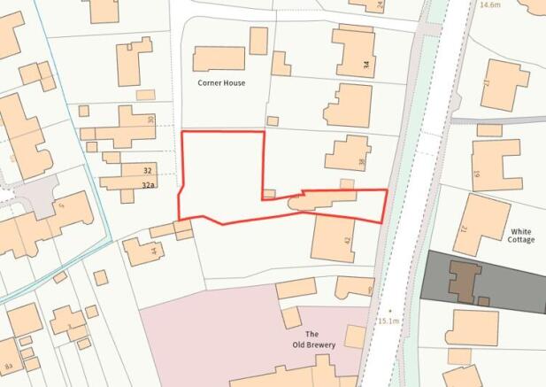
The freehold plot measures approximately 1,009 sqm (10,861 sq ft) and features a detached four-bedroom house of circa 147 sqm (1,587 sq ft), a separate outbuilding of circa 17 sqm (187 sq ft) and a large L-shaped rear garden.
The property further benefits from ample off-street parking and a fantastic village location within easy reach of Esher town centre, schools, and transport links.
Located within Elmbridge Borough the plot is within the West End (Esher) Conservation Area of West End Village in Esher.
West End pond is on the doorstep and Garsons Farm, a well-known farm shop/garden centre is within 0.3 miles away whilst Esher High Street and Claremont Gardens are under a mile away.
Tenure - Freehold HM Land Registry Title Number SY107106.
Energy Performance Certificates
EPCBrochures
West End Lane, Esher, Surrey, KT10

NEAREST STATIONS
Distances are straight line measurements from the centre of the postcode- Hersham Station1.0 miles
- Claygate Station1.4 miles
- Esher Station1.5 miles
About Dexters Development & Investment, South London
Dexters Wimbledon, 12 The Broadway London SW19 1RFNotes
Disclaimer - Property reference 40WestEndLane. The information displayed about this property comprises a property advertisement. Rightmove.co.uk makes no warranty as to the accuracy or completeness of the advertisement or any linked or associated information, and Rightmove has no control over the content. This property advertisement does not constitute property particulars. The information is provided and maintained by Dexters Development & Investment, South London. Please contact the selling agent or developer directly to obtain any information which may be available under the terms of The Energy Performance of Buildings (Certificates and Inspections) (England and Wales) Regulations 2007 or the Home Report if in relation to a residential property in Scotland.
Map data ©OpenStreetMap contributors.