
Land At Nathan Way, Thamesmead, London, SE28
- SIZE AVAILABLE
101,930 sq ft
9,470 sq m
- SECTOR
Storage facility to lease
Lease details
- Lease available date:
- Ask agent
Key features
- Fully fenced and secure
- Water & power
- Flexible lease terms to be provided
- Good transport links
- The site extends to 3.69 acres (1.49 hectares).
Description
EPC
Not applicable.
Fully fenced and secure
Water & power
Flexible lease terms to be provided
Good transport links
Location
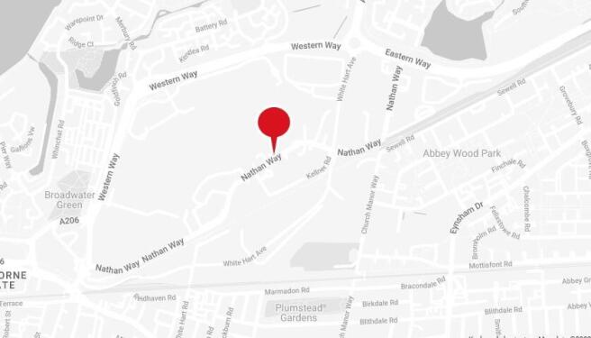
The site is situated fronting onto the south side of Nathan Way close to its junction with Kellner Road on the West Thamesmead Business Park.
Nathan Way provides easy access into Plumstead and Woolwich, and access to mainline, DLR, and Elizabeth Line services.
Local trains provide services to London City Airport, Canary Wharf and the City with the Elizabeth Line serving Paddington and Heathrow.
The Woolwich Ferry is approximately 2 miles away and the Blackwell Tunnel 5 miles to the West whilst the M25 at Dartford is 10 miles to the East.
The site extends to 3.69 acres (1.49 hectares).
Brochures
Land At Nathan Way, Thamesmead, London, SE28

NEAREST STATIONS
Distances are straight line measurements from the centre of the postcode- Plumstead Station0.7 miles
- Abbey Wood Station1.1 miles
- Woolwich Station1.2 miles
Notes
Disclaimer - Property reference 42021LH. The information displayed about this property comprises a property advertisement. Rightmove.co.uk makes no warranty as to the accuracy or completeness of the advertisement or any linked or associated information, and Rightmove has no control over the content. This property advertisement does not constitute property particulars. The information is provided and maintained by Glenny, South East London and Kent. Please contact the selling agent or developer directly to obtain any information which may be available under the terms of The Energy Performance of Buildings (Certificates and Inspections) (England and Wales) Regulations 2007 or the Home Report if in relation to a residential property in Scotland.
Map data ©OpenStreetMap contributors.