
Edenbridge Road, Hartfield, East Sussex, TN7

- PROPERTY TYPE
Land
- SIZE
4,843,872 sq ft
450,011 sq m
Key features
- About 1.5 miles to north of Hartfield in East Sussex
- Approximately 111.20 acres in total
- Predominantly permanent pasture
- About 27 previously used for arable cropping
- Interspersed with areas of woodland, natural streams, and several ponds
- Fine views over Wealden countryside
Description
pasture, with about 27 acres previously used for arable cropping. In all 111.20 acres.
Description
Lot 1 - Bolebroke West
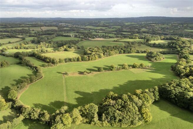
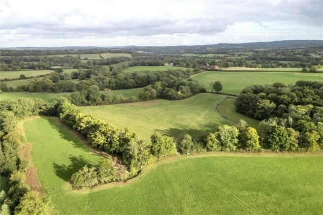
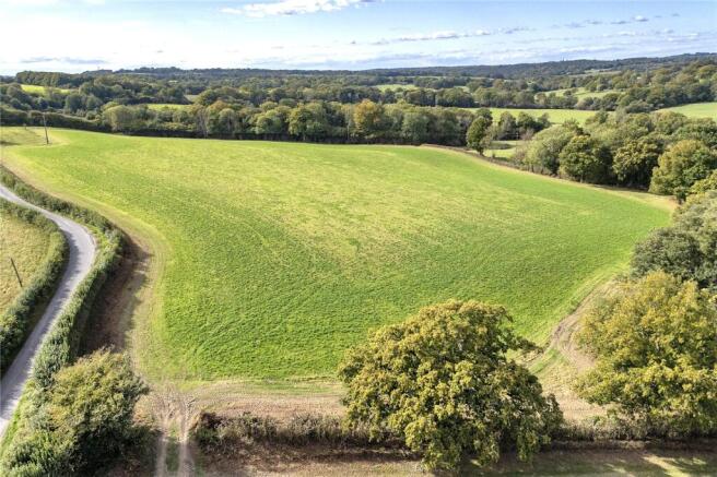
Lot 1 is the largest parcel, extending to approximately 111.20 acres. The land comprises predominantly permanent pasture, with about 27 acres previously used for arable cropping. It is attractively interspersed with areas of woodland, natural streams, and several ponds, enhancing its biodiversity and sporting appeal.
Access is available from both Butcherfield Lane and Edenbridge Road.
A stream forms the eastern boundary, providing a natural division between Lots 1 and 2.
General Remarks
Method of Sale:
The property is offered for sale by private treaty as a whole or in up to 3 Lots.
Tenure and Possession:
The tenure of the property is freehold.
The land is currently farmed under a grazing licence, which expires on 27th February 2026 although earlier vacant possession could be available by negotiation.
The land forms part of a local syndicate shoot and their agreement covers the 2025/26 season until 1st February 2026.
Plans, Areas and Schedules:
The plans and associated acreages have been prepared for illustrative purposes and their accuracy cannot be guaranteed.
Countryside Stewardship Scheme:
The land at Bolebroke and 19 Acre are included in a Mid Tier Countryside Stewardship Scheme and a Sustainable Farming Incentive agreement.
The CSS is an agreement in place that covers the vendor’s wider holding. The scheme ends 31/12/2027 and the buyer will be expected to take on the scheme, adhere to its requirements and indemnify the vendor against any losses until it’s termination. Further details are available from the agents.
The SFI agreement is non-transferable. It ends 31/03/2027 and land will be removed from the vendor’s wider SFI agreement.
Local Authorities:
Wealden District Council
East Sussex County Council
Statutory Designations:
The land lies within the High Weald National Landscape.
Easements, Wayleaves and Rights of Way:
The property is offered for sale, subject to and with benefit of all rights of way either public or private, all easements, wayleaves and other rights of way whether specifically mentioned or not.
There are no scheduled Public Footpaths and Bridleways crossing the land.
Sporting, Timber and Mineral Rights:
The minerals, sporting and timber rights, so far as they are owned, are included in the sale.
Viewings & Health and Safety:
Given the potential hazards of visiting working farmland, viewers should take care and precaution with regard to their personal safety when viewing.
Acreage: 111.2 Acres
Directions
Directions
What3words (best for directions)
Lot 1 Bolebroke West (Bottom Park field access)
Lot 2 Bolebrook East (off Butcherfield Lane)
Lot 3 19 Acre (off Edenbridge Road)
Brochures
Web DetailsEdenbridge Road, Hartfield, East Sussex, TN7

NEAREST STATIONS
Distances are straight line measurements from the centre of the postcode- Ashurst Station2.1 miles
- Cowden Station3.0 miles
- Hever Station4.7 miles
Notes
Disclaimer - Property reference MRU250024. The information displayed about this property comprises a property advertisement. Rightmove.co.uk makes no warranty as to the accuracy or completeness of the advertisement or any linked or associated information, and Rightmove has no control over the content. This property advertisement does not constitute property particulars. The information is provided and maintained by Savills Rural Sales, Sevenoaks. Please contact the selling agent or developer directly to obtain any information which may be available under the terms of The Energy Performance of Buildings (Certificates and Inspections) (England and Wales) Regulations 2007 or the Home Report if in relation to a residential property in Scotland.
Map data ©OpenStreetMap contributors.