Kensington High Street, London, W8
- SIZE AVAILABLE
1,714 sq ft
159 sq m
- SECTOR
High street retail property for sale
- USE CLASSUse class orders: A1 Shops
A1
Key features
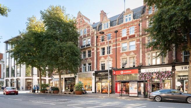
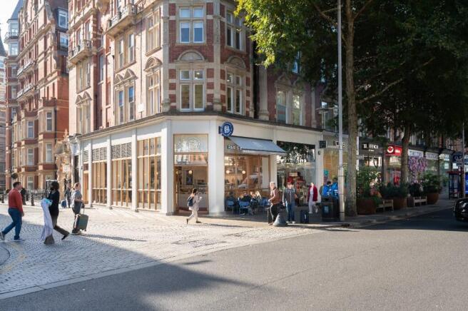
- Comprising a Central London shop extending to a total of approx. 159.2 sq m (1,714 sq ft)
- Let to Rituals Cosmetics UK Limited on a lease expiring in 2029
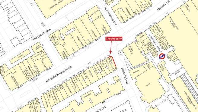
- Located very close to High Street Kensington Underground Station
- Affluent and popular area of Central London, close to Kensington Palace, Hyde Park & Holland Park
- Occupiers close by include Boots, M&S, The Ivy, McDonalds, Zara Home & Massimo Dutti
- VAT is applicable
Description
Comprising a Central London shop extending to a total of approx. 159.2 sq m (1,714 sq ft)
Let to Rituals Cosmetics UK Limited on a lease expiring in 2029 (5)
Located very close to High Street Kensington Underground Station (Circle & District lines)
Affluent and popular area of Central London, close to Kensington Palace, Hyde Park & Holland Park
Occupiers close by include Boots, M&S, The Ivy, McDonalds, Zara Home & Massimo Dutti
VAT is applicable
Kensington High Street, London, W8

NEAREST STATIONS
Distances are straight line measurements from the centre of the postcode- High Street Kensington Station0.1 miles
- Earls Court Station0.6 miles
- Notting Hill Gate Station0.6 miles
Notes
Disclaimer - Property reference Kensington2. The information displayed about this property comprises a property advertisement. Rightmove.co.uk makes no warranty as to the accuracy or completeness of the advertisement or any linked or associated information, and Rightmove has no control over the content. This property advertisement does not constitute property particulars. The information is provided and maintained by Prideview Group, Middlesex. Please contact the selling agent or developer directly to obtain any information which may be available under the terms of The Energy Performance of Buildings (Certificates and Inspections) (England and Wales) Regulations 2007 or the Home Report if in relation to a residential property in Scotland.
Map data ©OpenStreetMap contributors.